There’s A Map For That (21 Interesting Pics)
You guys liked the charts and graphs so much I thought this would also be a fun post. Other than Google Maps, we don’t really think about maps too much anymore. Luckily there are still a few beautiful nerds out there making them, and they’re pretty great.
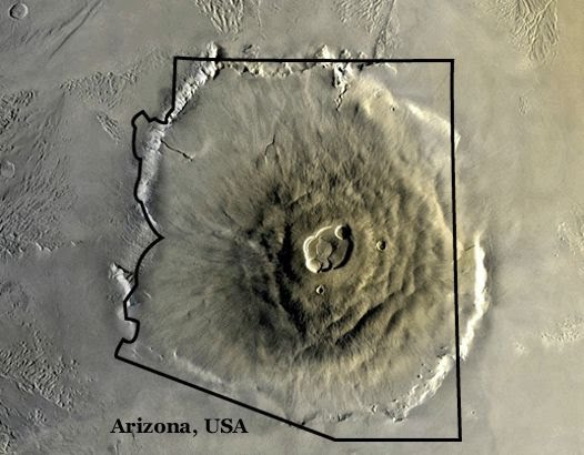
1. Olympus Mons on Mars, the largest volcano in our solar system, compared to Arizona.
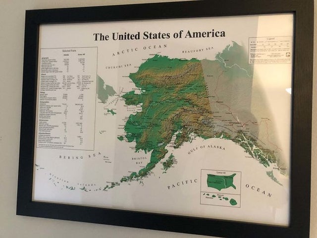
2. The United States of America: Alaskan perspective
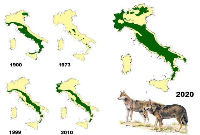
3. Wolf distribution in Italy from 1900 to 2020
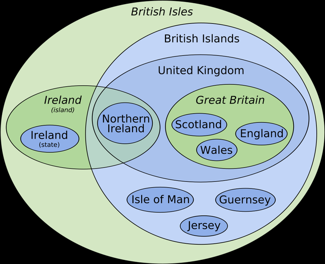
4. Euler diagram-map of the British Isles
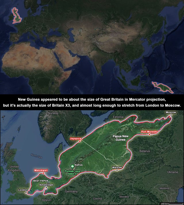
5. The true size of New Guinea.
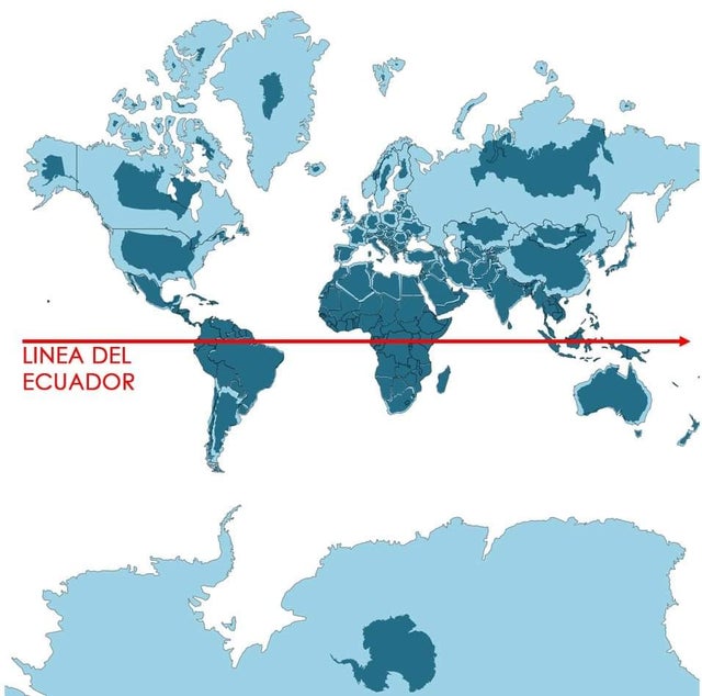
6. Light blue is a map as we know it and dark blue is the actual size of each country.
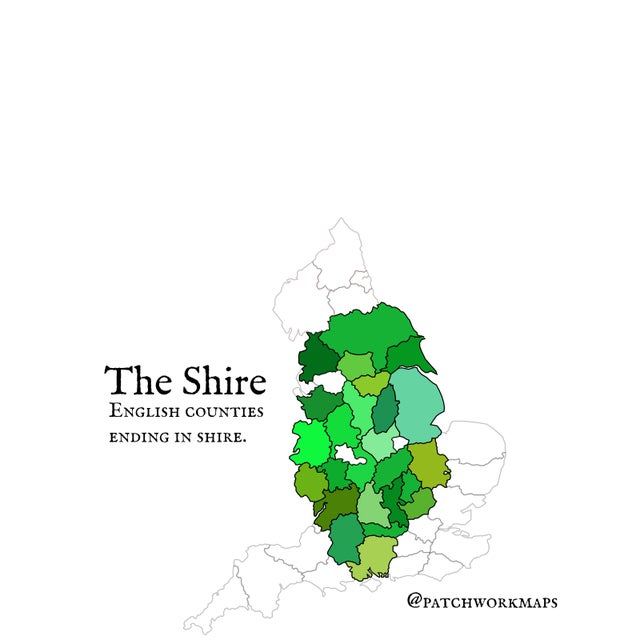
7. The Shire – English counties ending in ‘shire’
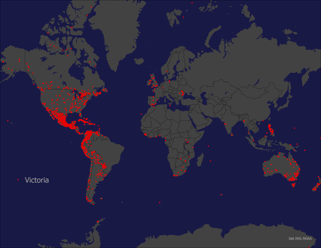
8. Places Named Victoria
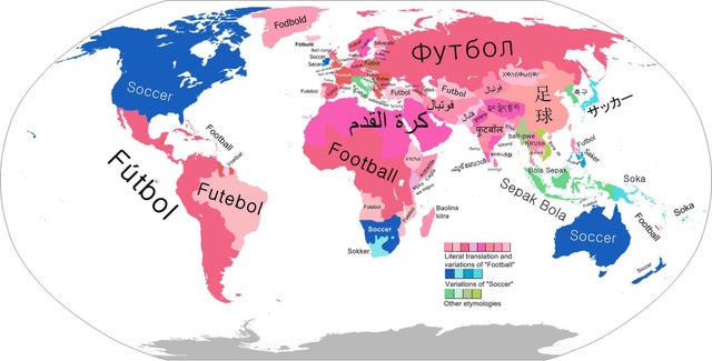
9. Countries who call it ‘football’ VS who call it ‘soccer’
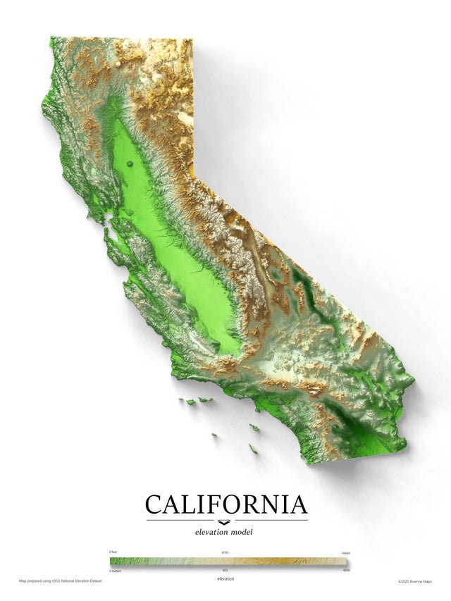
10. Exaggerated Elevation Map of California
11. The Topography of Italy

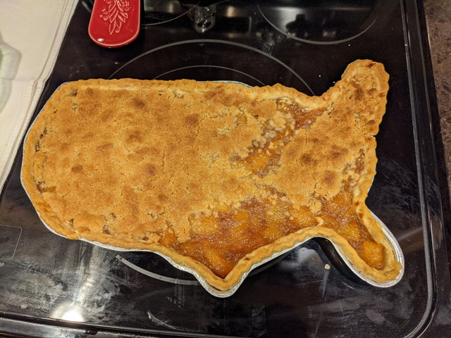
12. I (tried to) make a topographic pie of the United States.
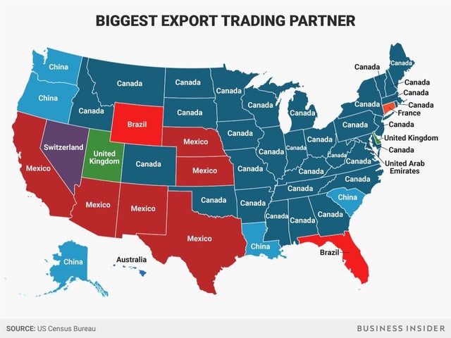
13. Each States Biggest Export Trading Partner
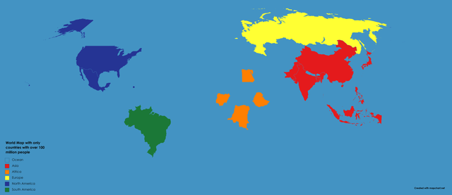
14. World Map excluding countries with under 100m people.
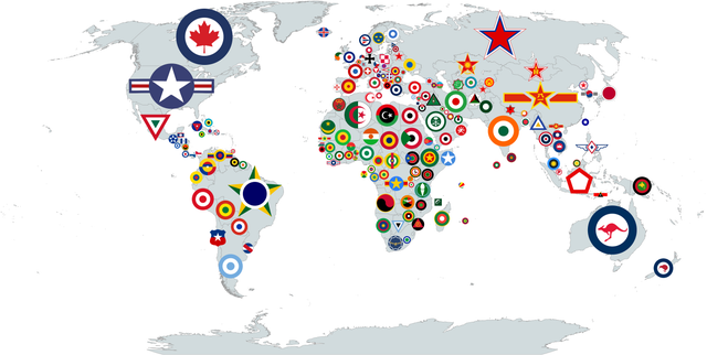
15. Roundels by country.
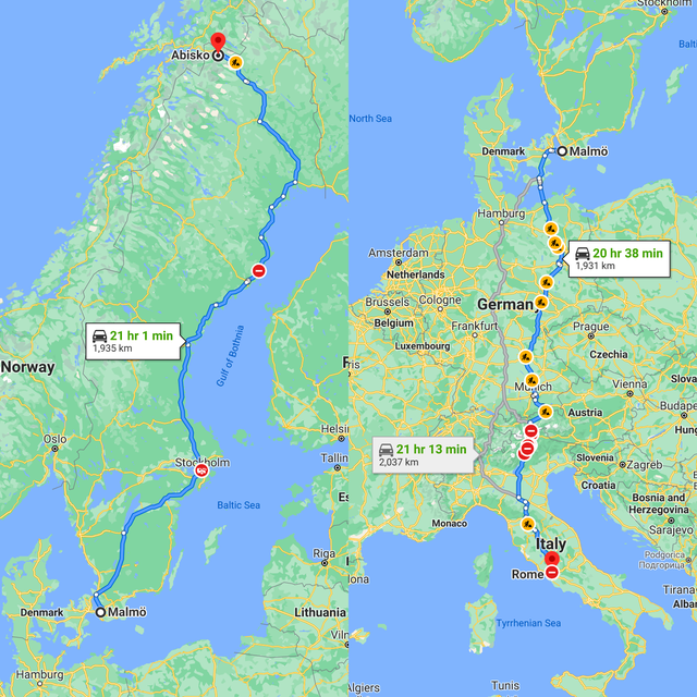
16. It would be longer to drive from Malmö to Abisko, both in Sweden, than to drive from Malmö to Rome through five countries.
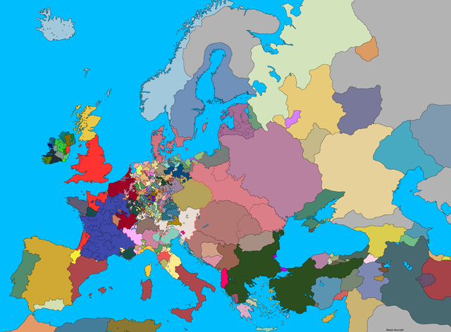
17. Europe 1444 without any writing.
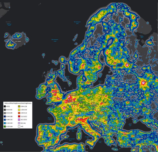
18. Light pollution map of Europe.
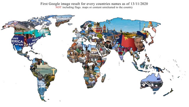
19. A map I made of every image that came up first when I searched each country’s name.
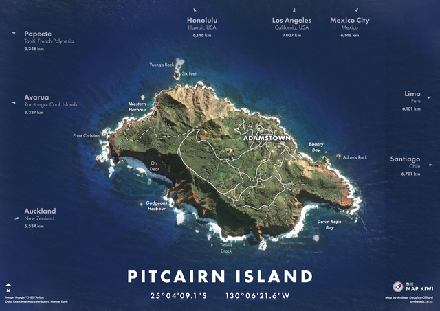
20. Pitcairn Island – one of the least populated and most remote territories in the world.
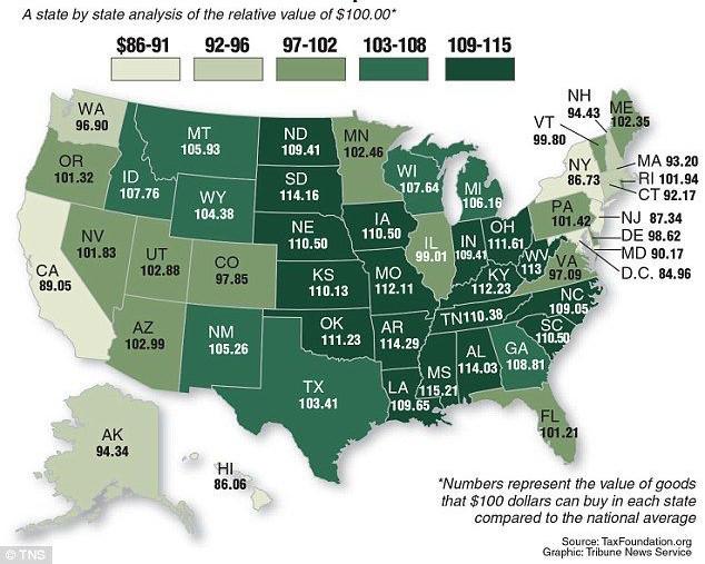
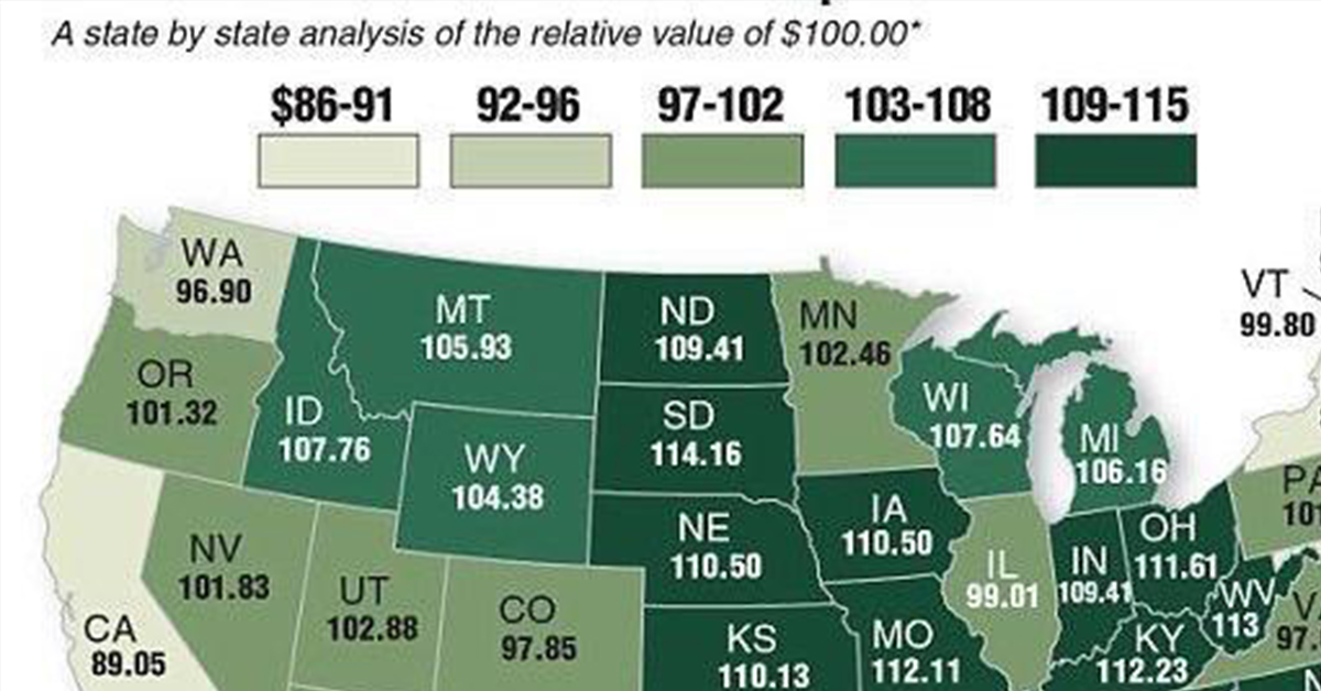
21. Relative value of $100