I remember when Google Earth was first created. It blew my mind but it was kind of weird to see a picture of my house on the internet.
I went to Hawaii about a year ago for the first time and if I had known how much the world was gonna change in just a few months, I would’ve stayed. People are working from home, Zoom Meetings are the new normal, and who knows when we’ll be able to travel again.
Thanks to Google Earth you can visit anywhere in the world from the comfort of your own couch. We’ve included the coordinates for every weird Google Earth destination we found.
1. Airplane Boneyard — Tucson, Arizona
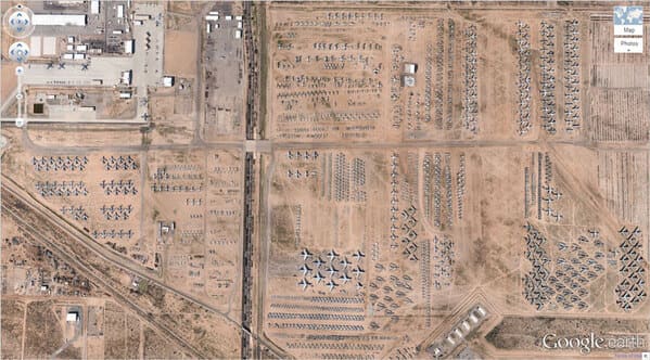
This is an areal view of the Davis-Monthan Air Force Boneyard in Tucson, Arizona. It began after World War II and it’s the largest military aircraft boneyard in the world.
2. Mysterious Desert Pattern — Red Sea Governorate, Egypt
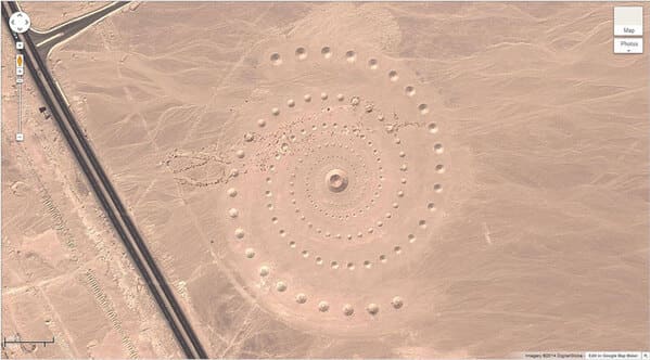
Believe it or not, this isn’t a landing pad for a spaceship but it is a 1 million square foot piece of artwork called — Desert Breath — to celebrate “the desert as a state of mind, a landscape of the mind,” according to the artists’ website.
3. Buffalo Herd — Kigosi Game Reserve, Tanzania
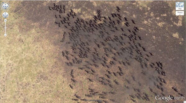
Here, we see a herd of water buffalo at the Kigosi Game Reserve in Tanzania.
4. Giant Triangle — Wittmann, Arizona, USA
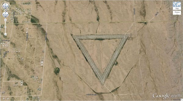
According to AZ Central, the “Giant Triangle” was likely used as an airstrip for Luke Air Force Base and part of an airfield that is now used for instrument training by F-16 pilots.
5. Shipwrecked SS Ayrfield with Trees — Homebush Bay, Sydney, Australia
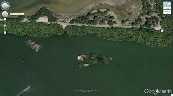
The SS Ayrfield is one of many decommissioned ships in the Homebush Bay, just west of Sydney, but it stands out from others is the incredible “forest” that adorns the rusted hull.
6. The Badlands Guardian — Walsh, Alberta, Canada
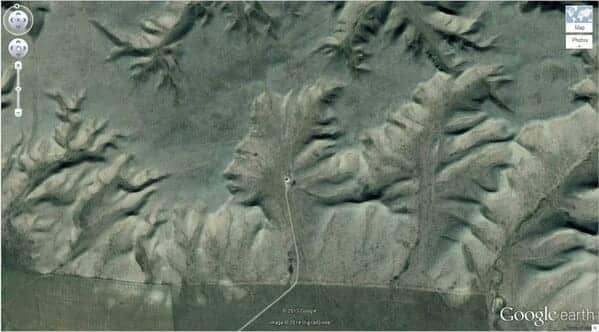
The Badlands Guardian is a geomorphological feature located near Medicine Hat in the southeast corner of Alberta, Canada.
7. Jesus Loves You — Boise National Forest, Boise, Idaho, USA
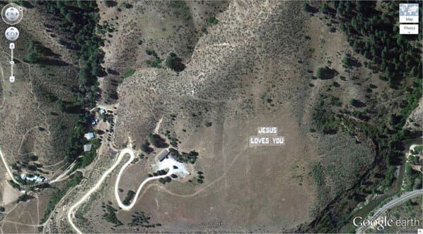
Jesus Love You — each letter is about 31 feet (9.5 meters) long.
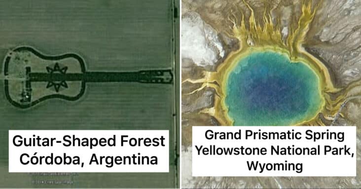
8. Guitar-Shaped Forest — Córdoba, Argentina
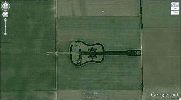
The guitar forest, planted by farmer Pedro Martin Ureta and his four kids that planted every individual tree decades ago in memory of his wife, Graciela Yraizoz.
9. Heart-Shaped Lake — Columbia Station, Ohio, USA
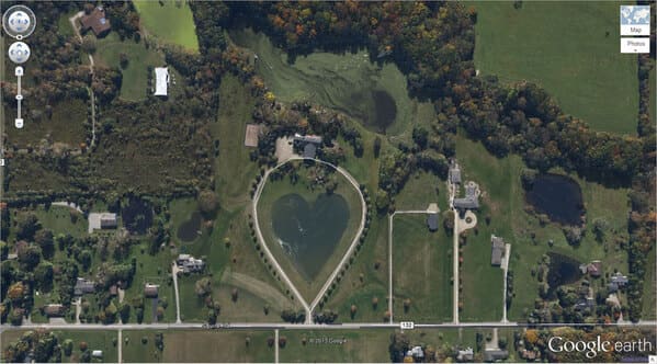
A heart-shaped lake located in Columbia Station, Ohio.
10. Mysterious Desert Pattern — China
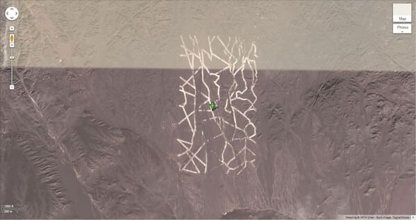
Upon further investigation by Guardian, the mysterious desert pattern appears to be mining, power, and military sites.
11. Giant Target — Nevada, USA
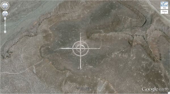
This giant target is likely used for military training. Definitely not aliens…
12. Whipsnade White Lion — Dunstable LU6 2LD, UK
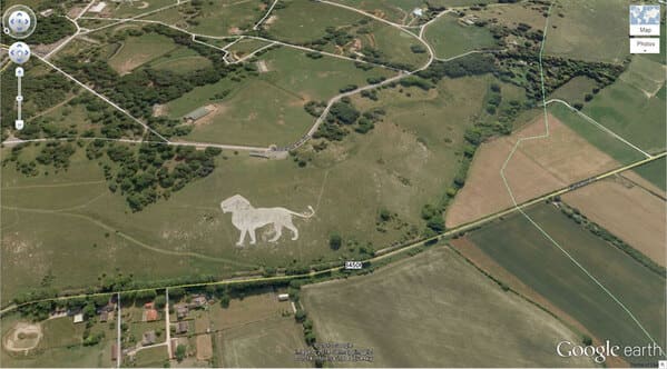
The Whipsnade White Lion was built in 1933. It was designed by Mr. R.B. Brooke-Greaves to indicate the position of Whipsnade wildlife park. The lion is home to a colony of cavies and wallabies which can be seen occasionally on the lion.
13. Northern Cyprus Flag. — Kyrenia, Cyprus
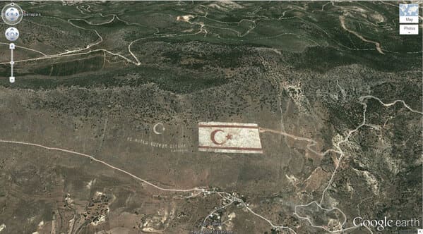
A painting of the Northern Cyprus flag on a mountain near Nicosia/Cyprus.
14. Potash Ponds — Moab, Utah, USA
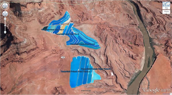
According to Atlas Obscura, the Moab potash mine and evaporation ponds are located about 10 miles southwest of Moab in southeastern Utah. They are also located in between Arches National Park to the north and Canyonlands National Park to the southwest.
15. Mysterious Pattern — Nevada, USA
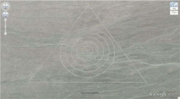
This is another formation likely a part of an airfield that is now used for instrument training by F-16 pilots in Nevada.
16. Coca Cola Logo — Arica, Arica y Parinacota, Chile
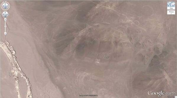
According to Atlas Obscura, created to commemorate Coke’s 100th anniversary, the logo is a simple one – that classic Coca-Cola script with a caption beneath it that originally read “100 años” – 100 years.
17. Island in a Lake in an Island in a Lake — Northern Canada
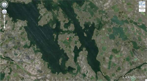
The only island in a lake on an “island in a lake on an island” located in Northern Canada. I didn’t even know this was a thing but it’s pretty cool.
18. Strange Symbol — Nevada, USA
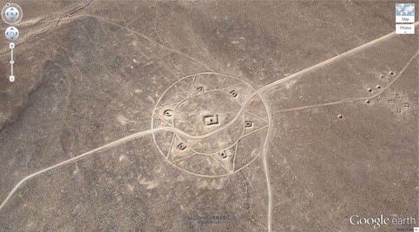
This is also another likely symbol used for military training in Nevada. Plenty of space in the desert!
19. Monkey Face — Russia
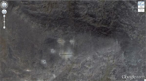
This is a formation that looks like a monkey’s face located in Russia.
20. The Most Phallic Building — Dixon, Illinois, USA
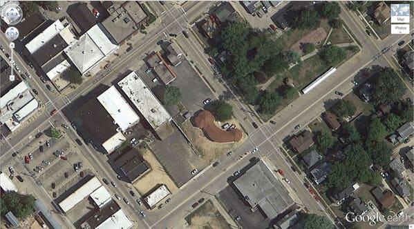
Believe it or not, this penis-shaped building is a church.
21. Mattel Logo — El Segundo, California
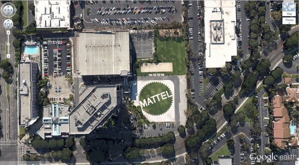
The Matell headquarters in el Segundo, CA has a logo installation that is visible from space.
22. Oil Fields — Rio Negro, Argentina
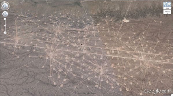
These bizarre lines are actually an oil field in Río Negro Province, Argentina.
23. Uluru / Ayers Rock — Northern Territory, Australia
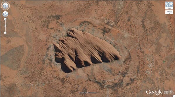
Uluru, or Ayers Rock, is a massive sandstone monolith in the heart of the Northern Territory’s arid “Red Centre”.
24. 1:20 Scale Model of Disputed Border Region
between India and China — Yong Ning Xian, Yinchuan, Ningxia, China
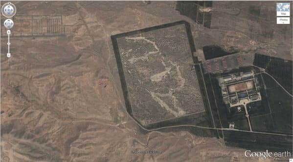
This scale model represents – a region occupied by China but claimed by India near north-central India.
25. UTA Flight 772 Desert Memorial — Sahara Desert, southern Ténéré of Niger
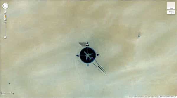
A memorial for UTA Flight 772 which crashed in the Sahara Desert on September 19, 1989.
26. Heart-Shaped Land Formation — New Caledonia
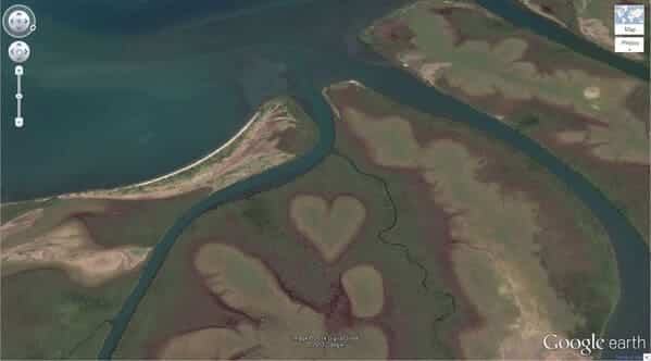
The Heart of Voh is a natural clearing formed by the mangroves.
27. Barringer Meteor Crater — Winslow, Arizona
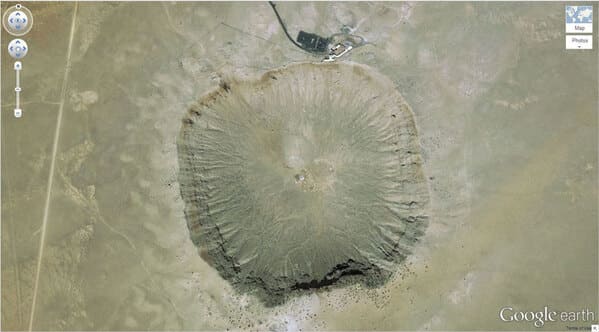
An areal view of the Barringer Meteor Crater — Winslow, Arizona created about 50,000 years ago during the Pleistocene epoch. (I’ve actually been here!)
28. Hippo Pool — Katavi National Park, Tanzania
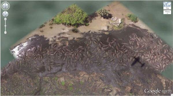
A play park for hundreds of hippos year-round, it offers a constant water supply from the converging Seronera and Orangi rivers in the Serengeti National Park.
29. Big Red Lips in the Desert — Sudan
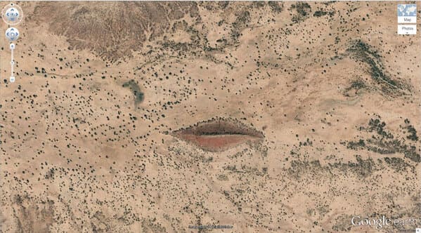
A cool land formation in the Sudan. Likely different colored sand that looks like a pair of red lips from above.
30. Grand Prismatic Spring — Yellowstone National Park, Wyoming, USA
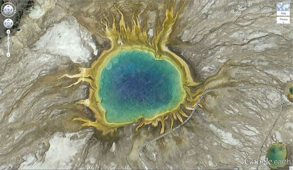
An areal view of the Grand Prismatic Spring at Yellowstone National Park, in Wyoming.
31. Batman Symbol — Okinawa, Japan
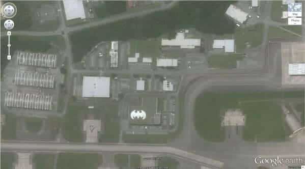
A batman symbol on the roof of a building in Okinawa, Japan.
More Cool Pics:
- 21 Times People Asked The Internet “What Is This Thing?” And The Internet Delivered
- This Is 2020 Broken Down By Trending Google Searches
- Museums Duel Over Who Has The Coolest Artifact In Their Collection (30 Pics)
- Travel Fails To Remind You Staying Home Isn’t Always So Bad (27 Pics)
- If You’re Going To Be One Of Those Couples That Gets Matching Tattoos, At Least Make Them Cool (34 Pics)


