18 Cool US Maps Divide The Country In A Pretty Dark Way
The United States of America is home to a lot of weird and interesting facts. I can’t think of any right now, but I’m sure there are at least 6 or so.
These maps, all created by awesome reddit users for r/mapporn, show some of the weirder US statistics in a dorky yet easy to digest way. It turns out that behind the red, white, and blue is a whole lot of tragedy and a couple UFOs.
1. All The Plane Crashes Since 1953 With More Than 100 Fatalities
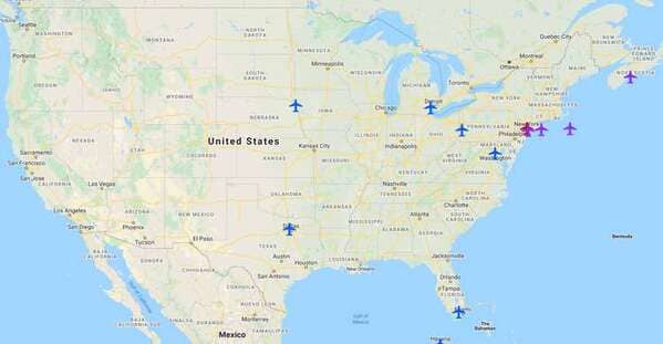
This map is interactive! Try it here!
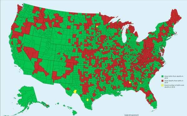
2. Births Vs. Deaths, 2018
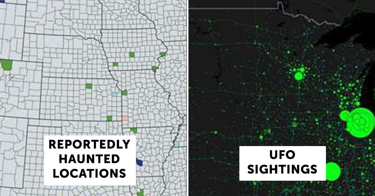
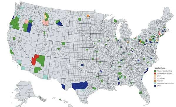
3. Reportedly Haunted Locations
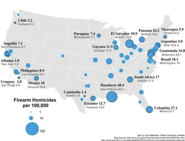
4. Firearm Homicides Per 100,000 In US Cities Compared To Other Countries
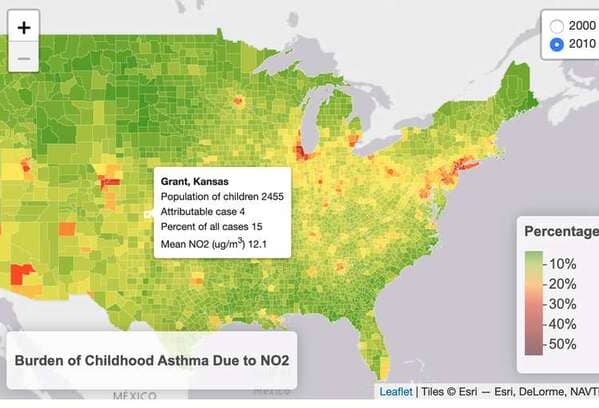
5. Childhood Asthma Caused By Pollution
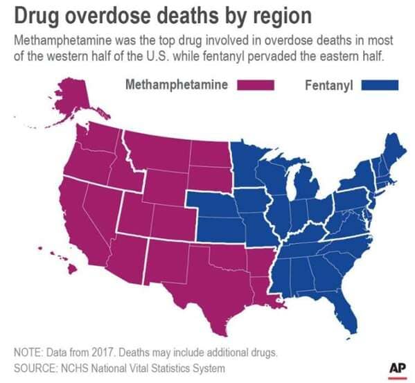
6. Overdoses By Region , 2017
7. Death Places Of American Presidents

8. Average Debt Of University Graduates, 2017-2018

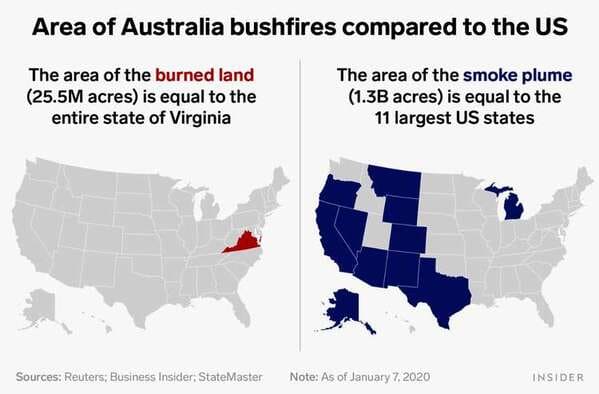
9. Area Of The Australian Bushfires Compared To The United States
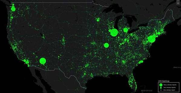
10. UFO Sightings, 1905-2015
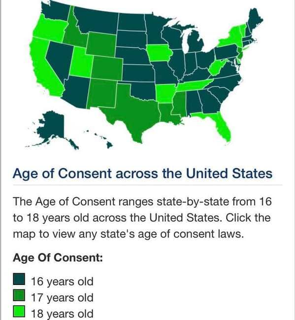
11. Age Of Consent By State
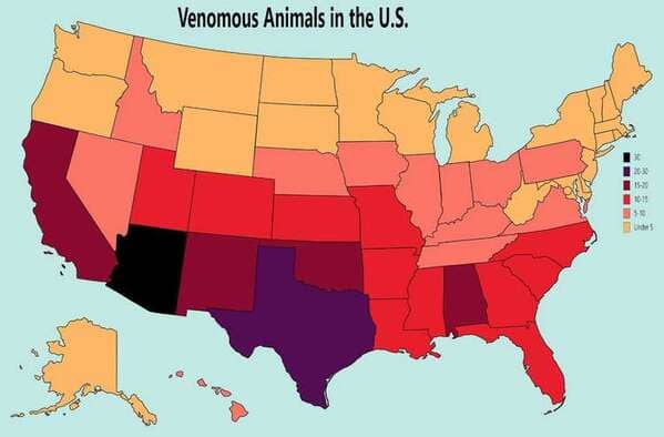
12. Venomous Animals
13. Cumulative Rates Of Smoking, Obesity, And Excessive Drinking

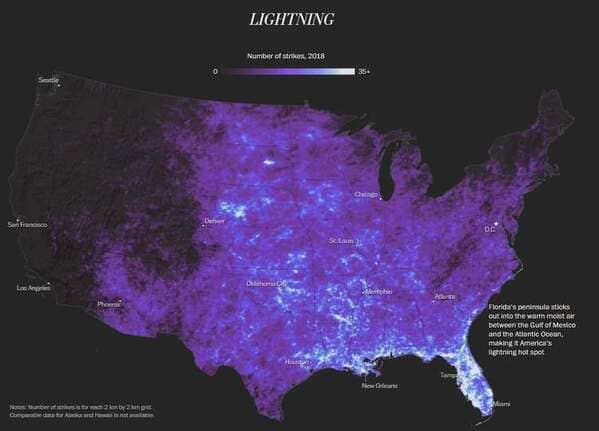
14. Lightning Strikes In The Contiguous United States, 2018
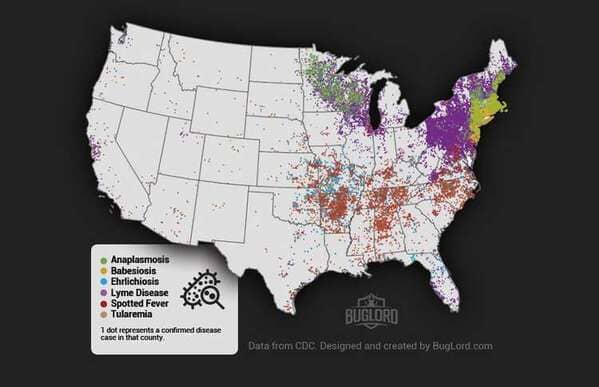
15. Tick-borne Disease Cases In The United States, 2017
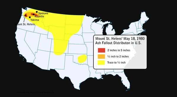
16. The Distribution Of Ash From The Eruption of Mount St. Helens, 1980
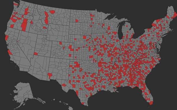
17. United States Counties, Or Equivalents, Named After Slave Owners
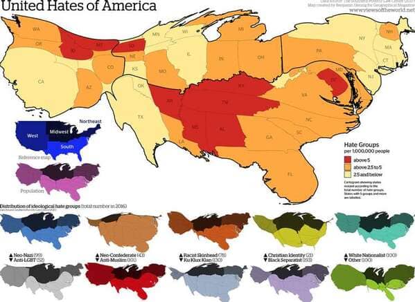
18. Cartogram Of Hate Groups, 2016
