There’s A Map For That (18 Interesting Pics)
You guys liked the charts and graphs so much I thought this would also be a fun post. Other than Google Maps, we don’t really think about maps too much anymore. Luckily there are still a few beautiful nerds out there making them, and they’re pretty great.
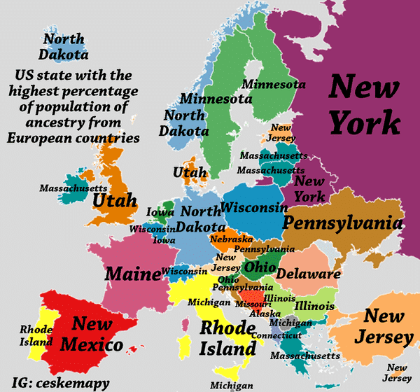
1. In which state you can find the highest percentage of people with ancestry from every European country?
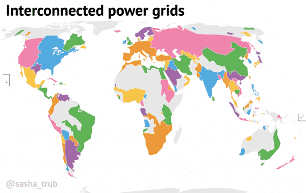
2. Interconnected power grids.
3. The topography of Vietnam.

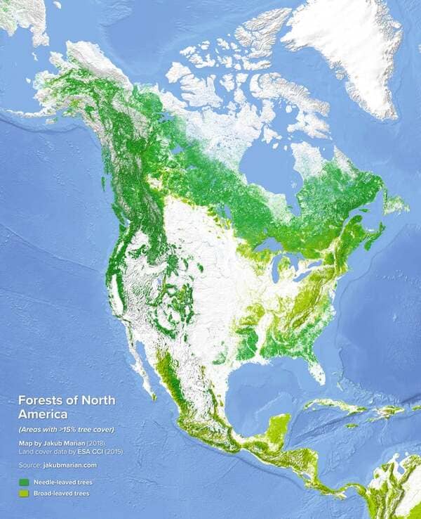
4. Forests of North America
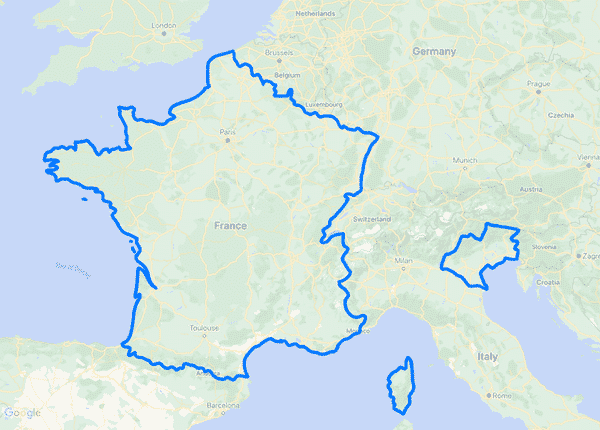
5. Map of France’s borders for about 10 minutes in 1866
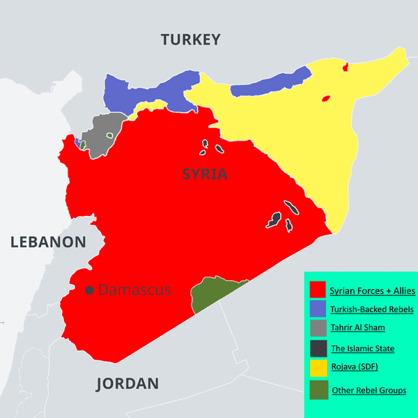
6. Syrian Civil War Map, February 2021
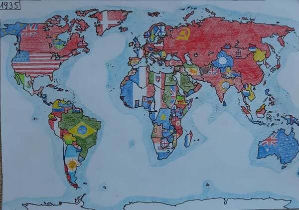
7. Hand-drawn map of the world in 1935.
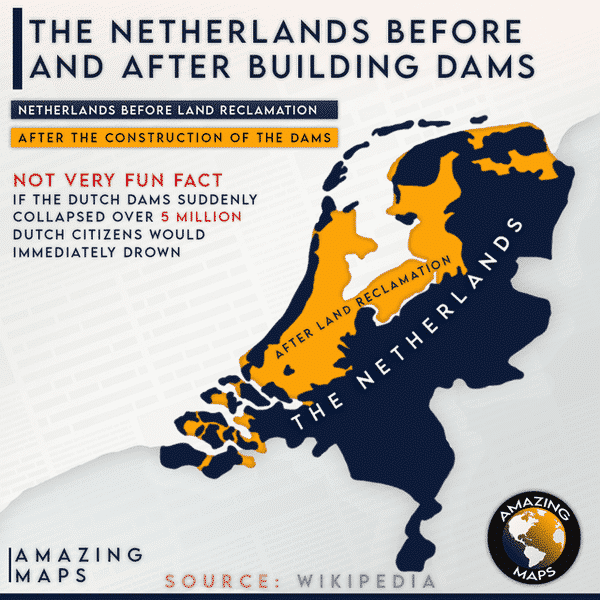
8. The Netherlands before and after.
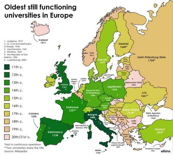
9. Oldest still open universities in Europe (the word university is omitted on the map)
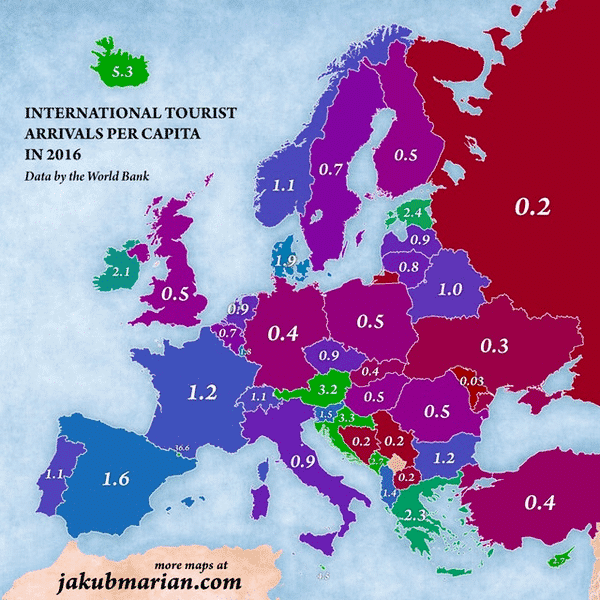
10. Number of tourists per capita of every European country.
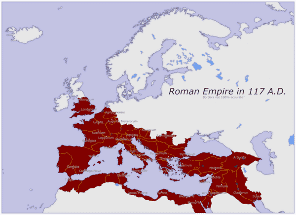
11. The Roman Empire at its greatest extent, 117 A.D.
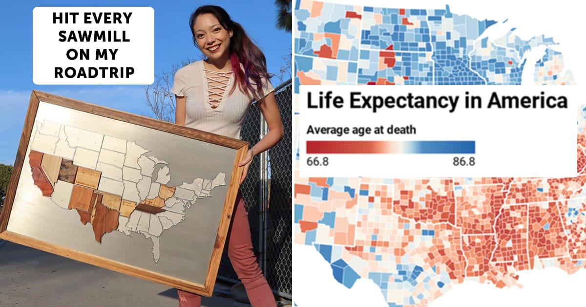
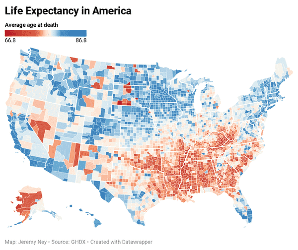
12. US life expectancy – America is now facing the greatest divide in life expectancy across regions in the last 40 years.
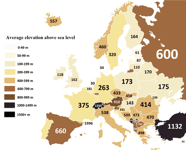
13. Average elevation above sea level of European countries.
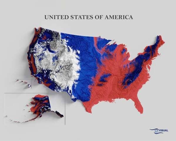
14. USA Shaded Relief Map
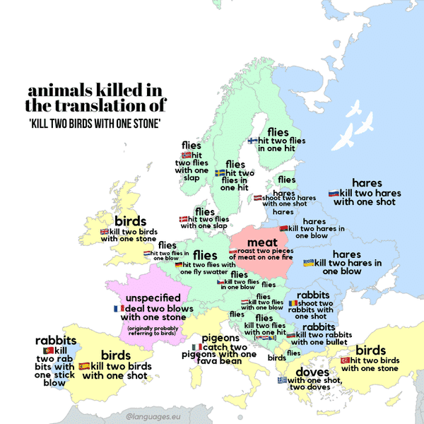
15. Translation of the idiom ‘kill two birds with one stone’ in European languages. @languages.eu
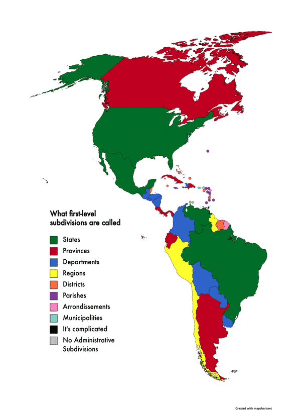
16. What countries in the Americas call their main first-level subdivisions.
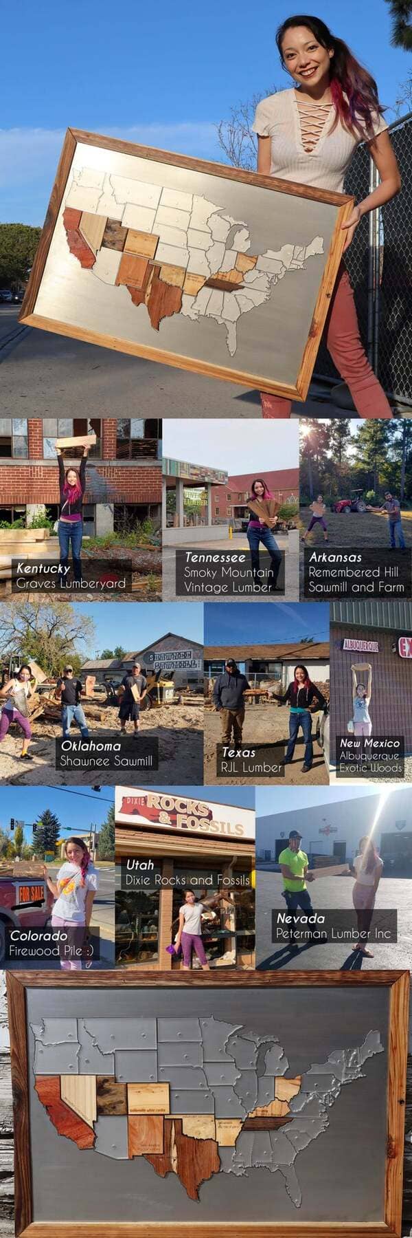
17. I drove across the USA visiting a sawmill in every state and made a map of local woods!
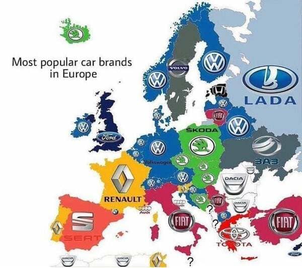
18. Most common car brand in each county in Europe.
