There’s A Map For That (21 Interesting Pics)
You guys liked the charts and graphs so much I thought this would also be a fun post. Other than Google Maps, we don’t really think about maps too much anymore. Luckily there are still a few beautiful nerds out there making them, and they’re pretty great.
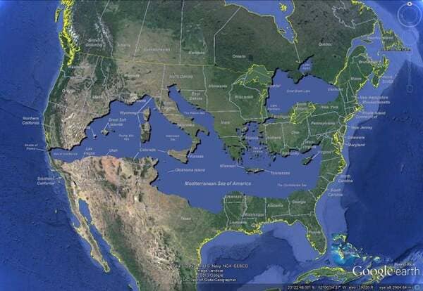
1. Mediterranean sea overlaid onto the US.
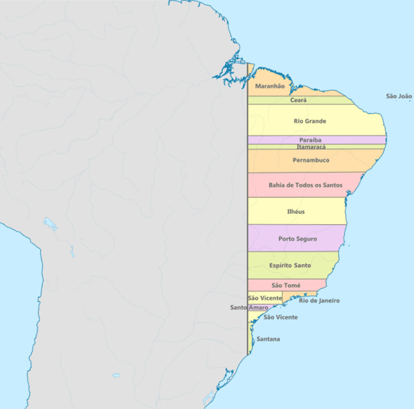
2. Brazil had straight borders in 1534.
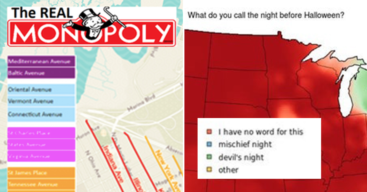
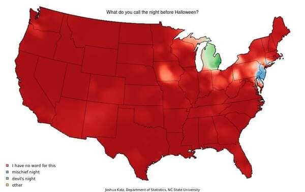
3. What do you call the night before Halloween?
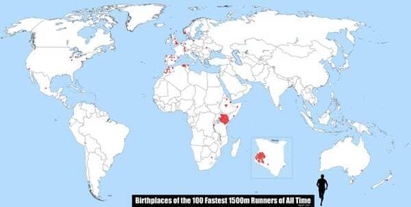
4. Birthplaces of the 100 Fastest 1500m Runners of All Time
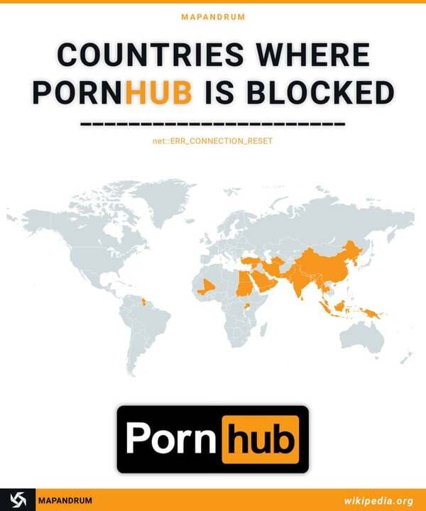
5. Countries where PH is banned.
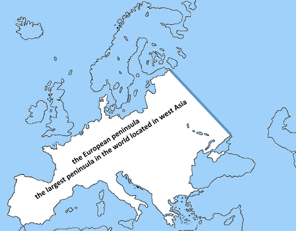
6. Ignoring aspects like culture and demographics, Europe is the largest peninsula in the world.
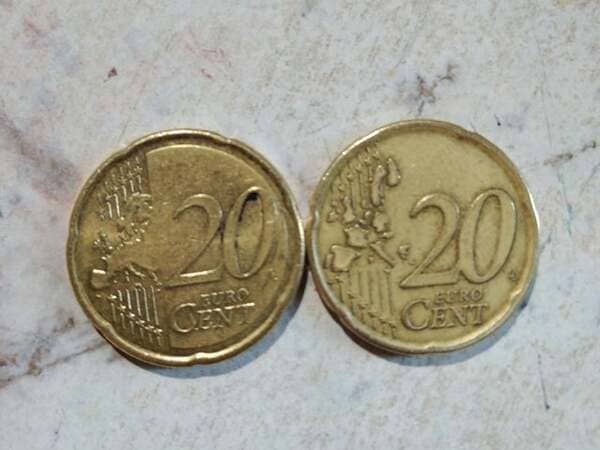
7. In olds Euro € coins, the borders of countries were drawn, not anymore (the left one is from 2009, the right one from 1999)
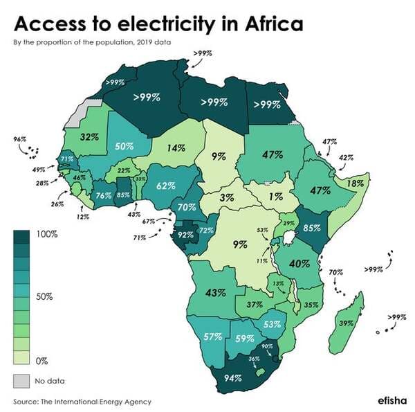
8. The proportion of the population in African countries having access to electricity.
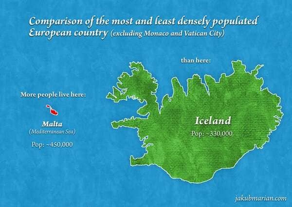
9. Malta vs Iceland
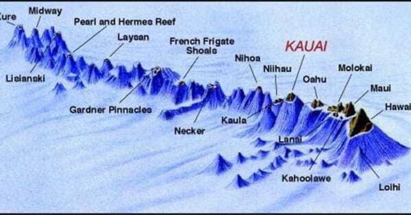
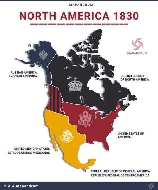
10. Hawaiian chain.
11. North America in 1830.
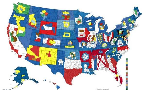
12. The flags of every U.S. state made out of their county lines.
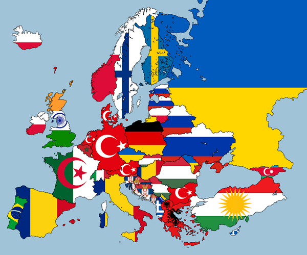
13. Second largest ethnicity in each European country.
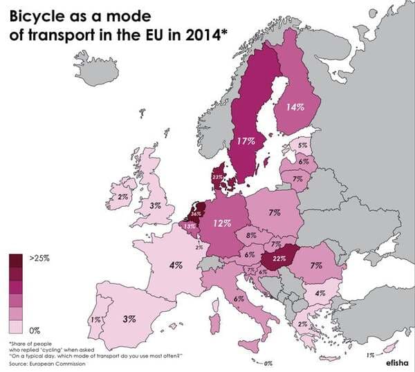
14. How many people in the EU use bicycles as their main mode of transport?
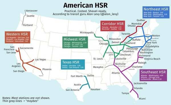
15. A Not Shockingly Unrealistic U.S. High Speed Rail Plan
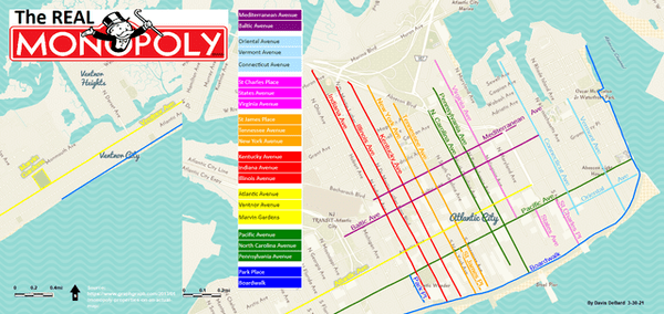
16. Here’s a map I made of the Real Monopoly streets located in Atlantic City
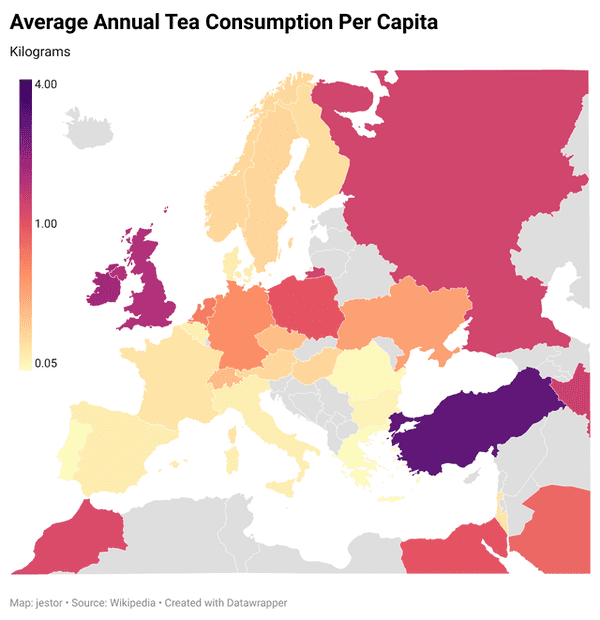
17. Annual Tea Consumption
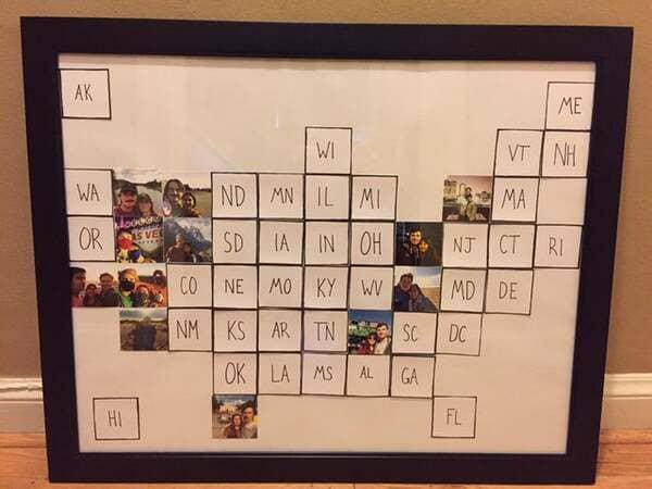
18. Tile map I made for my girlfriend of the states we’ve visited together.
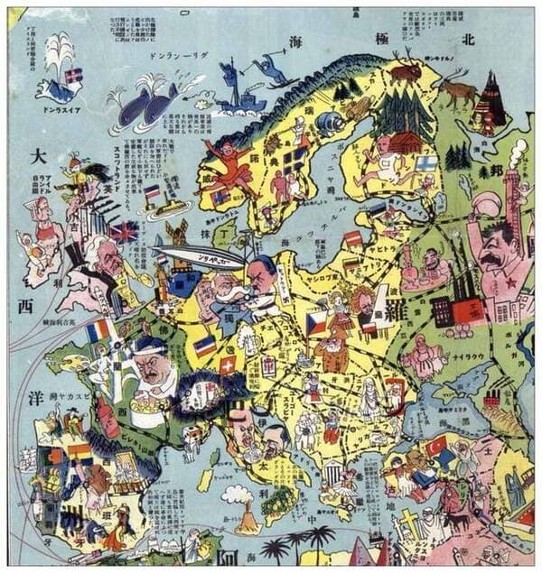
19. A Japanese map of European stereotypes, 1932
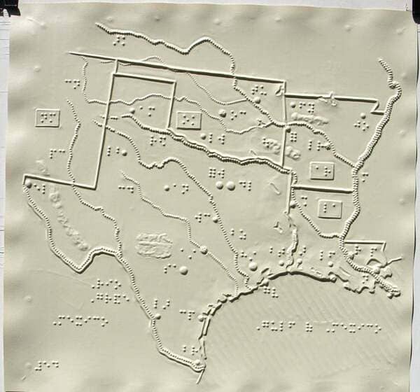
20. Braille map of southern US
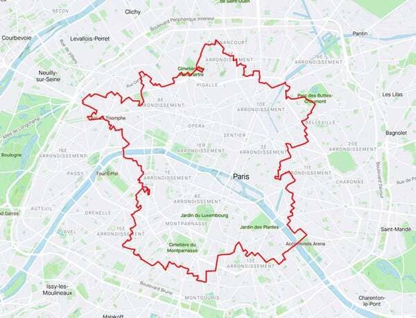
21. Tour de France without leaving Paris (by Pierre Breteau @pierrebrt)