There’s A Map For That (23 Interesting Pics)
You guys liked the charts and graphs so much I thought this would also be a fun post. Other than Google Maps, we don’t really think about maps too much anymore. Luckily there are still a few beautiful nerds out there making them, and they’re pretty great.
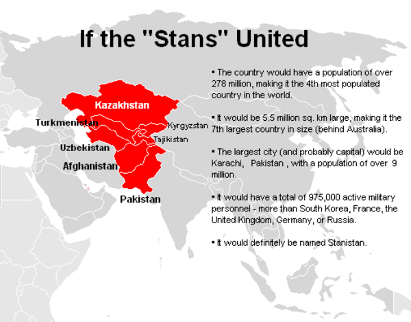
1.
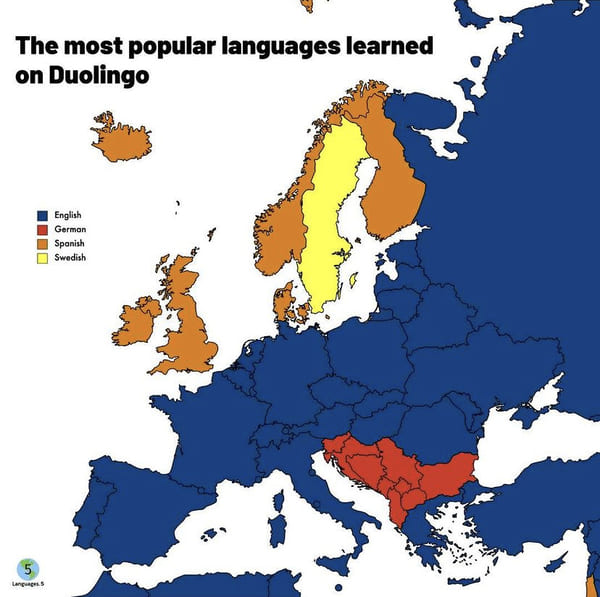
2.
3.
4.
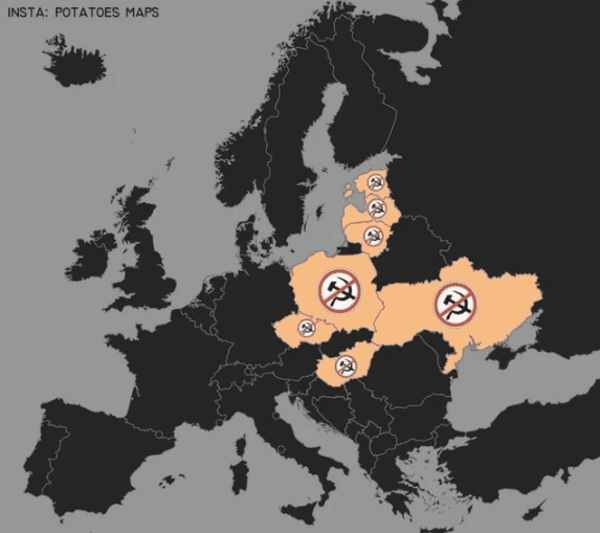
5. Countries where the public display of communist symbols is banned.
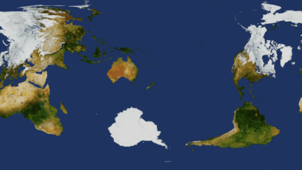
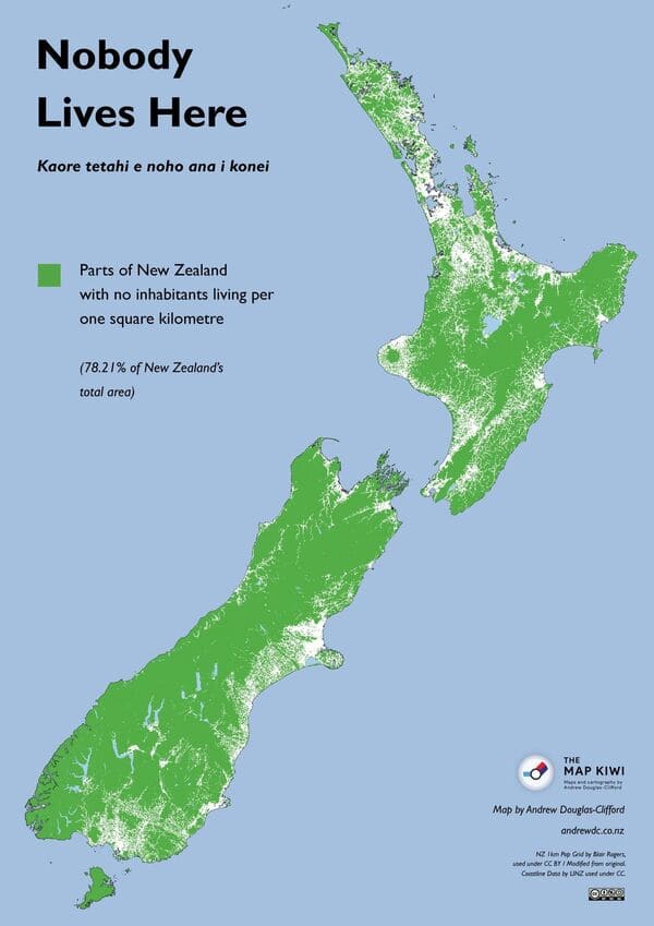
6. New Zealand as the center of the world.
7.
8.
9.
10.
11.
12.
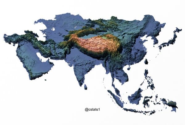
13. Topographic Map of Asia. Tibetan Plateau is just massive!
14.
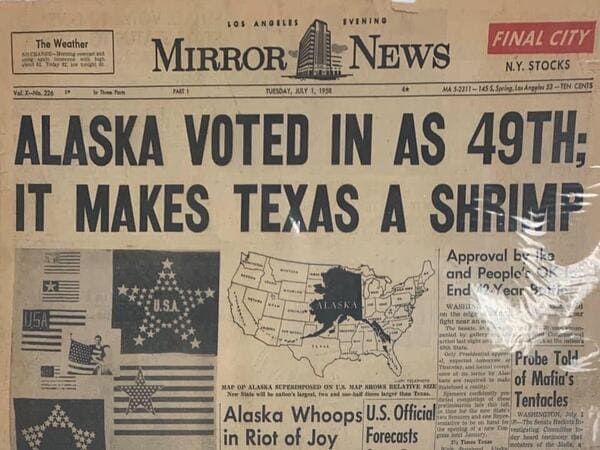
15. Map of Alaska and the 48th states in a newspaper from when Alaska gained statehood.
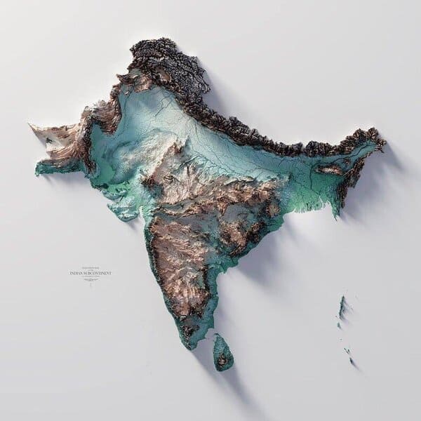
16. The Topography/Terrain Map of the Indian subcontinent.
17.
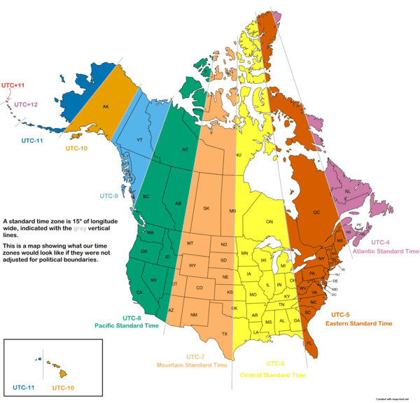
18. US/Canada time zones if they were not adjusted for political boundaries.
19.
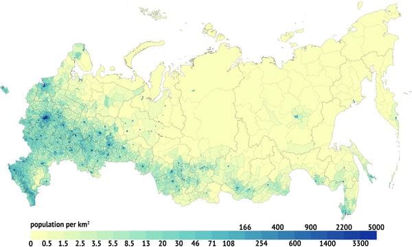
20. Population density map of Russia.
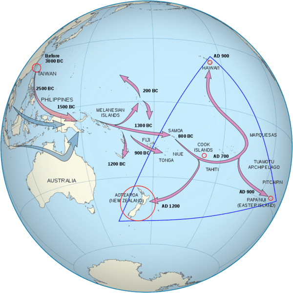
21. The Māori people descend from Polynesians whose ancestors emigrated from Taiwan to Melanesia between 3000 and 1000 BCE and then traveled east, reaching the Society Islands c. 1000 CE. After a pause of 200 to 300 years, a new wave of exploration led to the discovery and settlement of New Zealand.
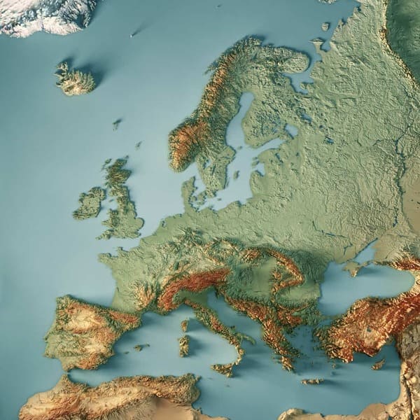
22. Raised relief map of Europe.
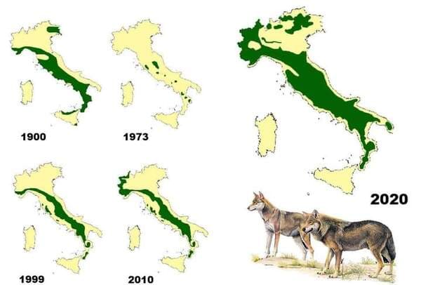
23. Wolf distribution in Italy since 1900.