30 Interesting Maps People Have Shared Online
We’re spoiled living in a day and age where we have a GPS on our phones. It’s almost impossible to get lost. I feel like I missed out on having to use an actual map to get somewhere. Nowadays, maps are great for visualizing data and learning something new.
There’s a whole community where people share interesting maps they’ve come across. Here are some of our favorites.
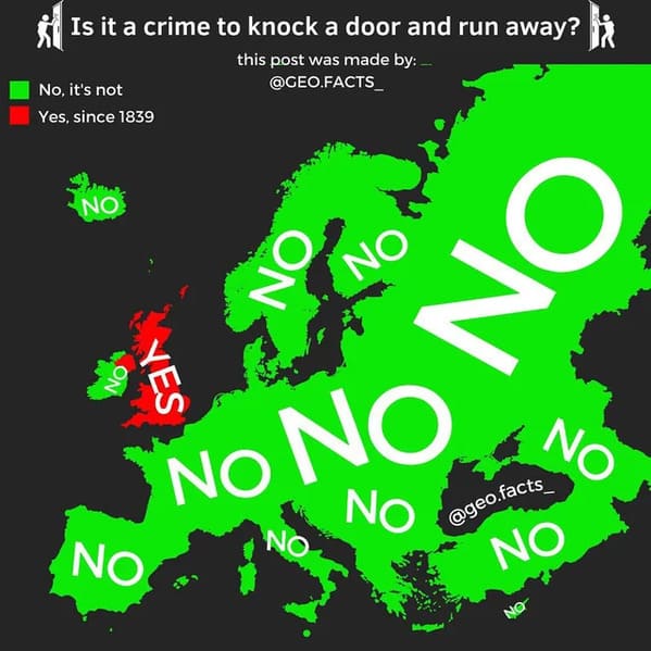
1. “Is it a crime to knock on the door and run away? (Source: uk legislation website – Metropolitan Police act of 1839)”
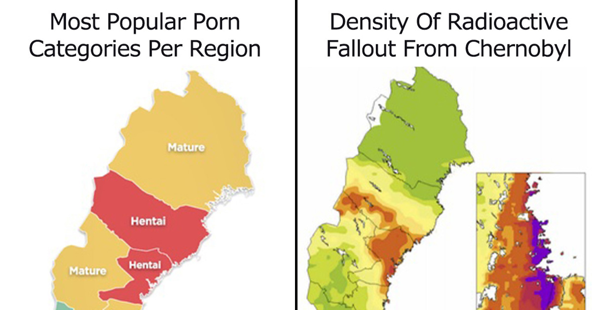
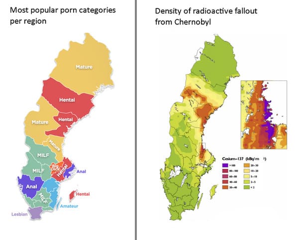
2. “Sweden’s porn preferences vs radiation level received from Chernobyl”
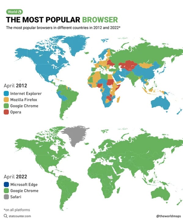
3. “The most popular browsers in different countries in 2012 and 2022”
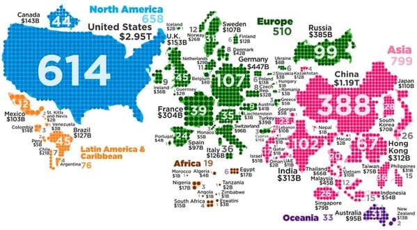
4. “World Map of Billionaires”
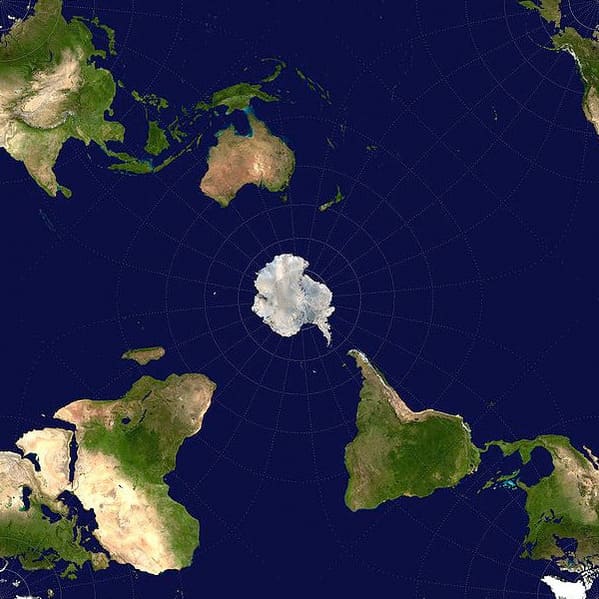
5. “World map centered on Antarctica”
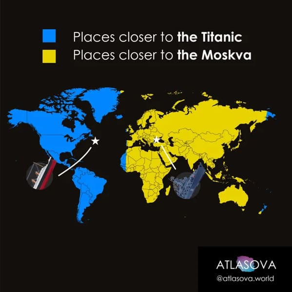
6. “Are you closer to the Titanic or the Moskva?”
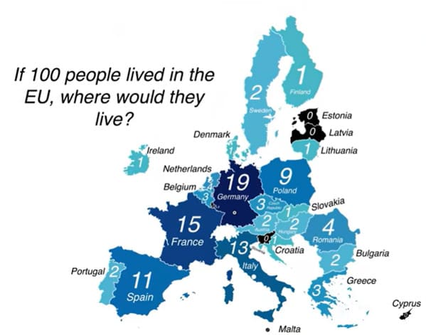
7.
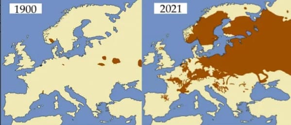
8. “Beavers in Europe (1900 and 2021)”
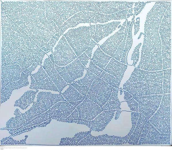
9. “City Of Montreal with ONE LINE”
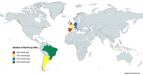
10. “World Cup Winners”
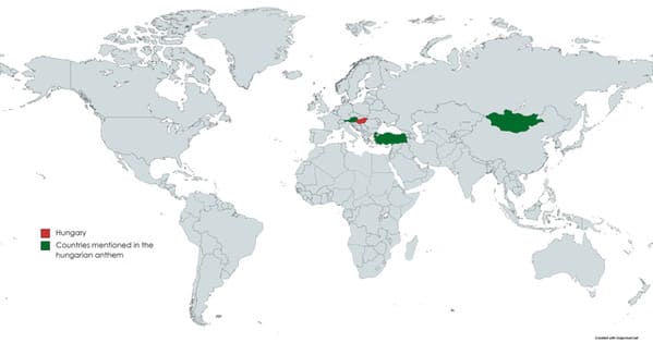
11. “Countries mentioned in the hungarian anthem”
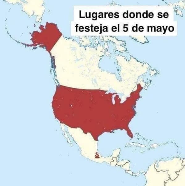
12. “Where is Cinco de Mayo celebrated?”
13.
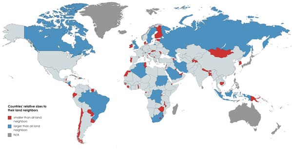
14. “All countries that are either larger (blue) or smaller (red) than all its neighbors”
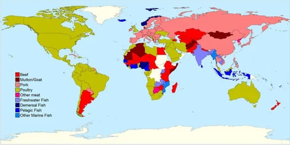
15. “Most consumed type of meat (or fish) by country”
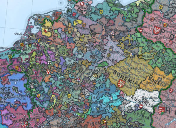
16. “Europe used to look like this, before it united.”
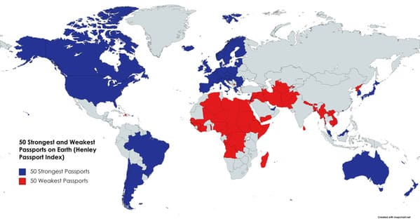
17. “50 Strongest and Weakest Passports”
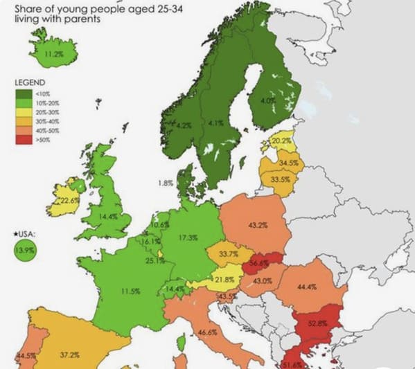
18. “Share of young people living with parents”
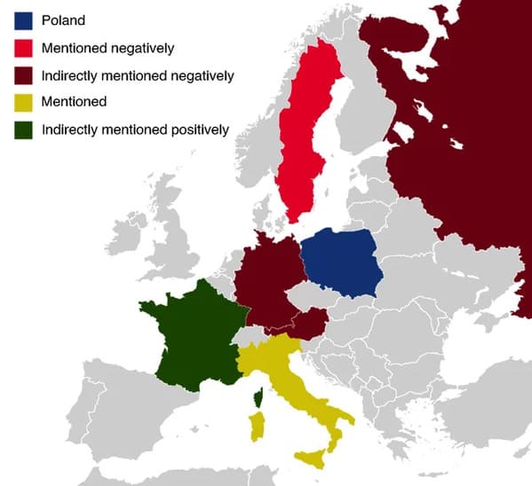
19. “Countries mentioned in the Polish anthem”
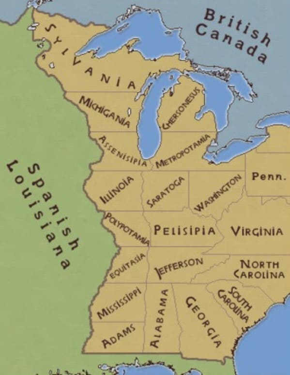
20. “Thomas Jefferson’s proposed map for western states”
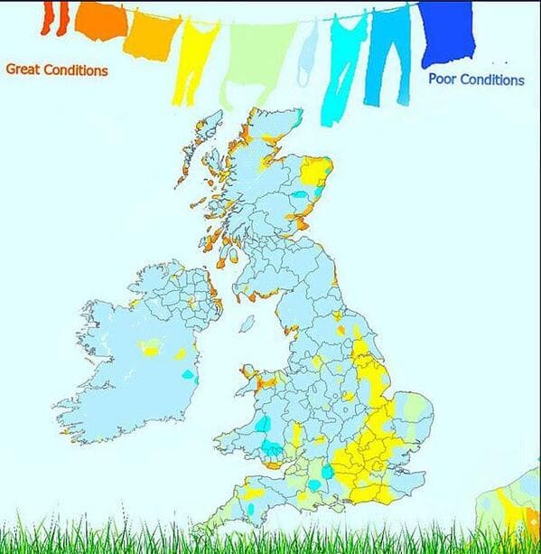
21.
22.
23. “Best laundry drying areas in the UK”
24.
25. “All the countries have been united with their biggest land border”