30 Unusual And Interesting Maps That Will Change Your Perspective On Cartography
We’re spoiled living in a day and age where we have a GPS on our phones. It’s almost impossible to get lost.
I feel like I missed out on having to use an actual map to get somewhere. They’re fun to look at and there’s a whole community where people share interesting maps they’ve come across.
Here are some of our favorites.
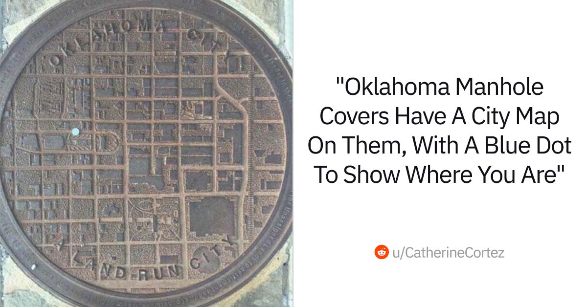
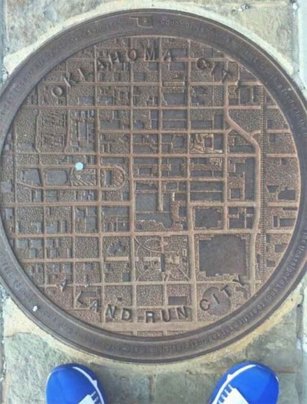
1. “Oklahoma Manhole Covers Have A City Map On, With A Blue Dot To Show Where You Are”
2. States Where Pornhub is Blocked as of July 1, 2024

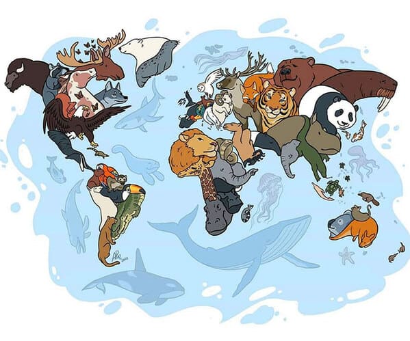
3. “Animals Of The World Map”
4. “Map Of Regional Rug Patterns Of Iran”

5.

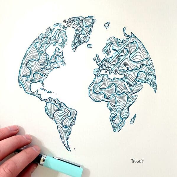
6. “Someone Joked That Instead Of Google Earth I Should Make Doodle Earth. I Liked The Idea So I Gave It A Shot”
7. “World Map Mural”

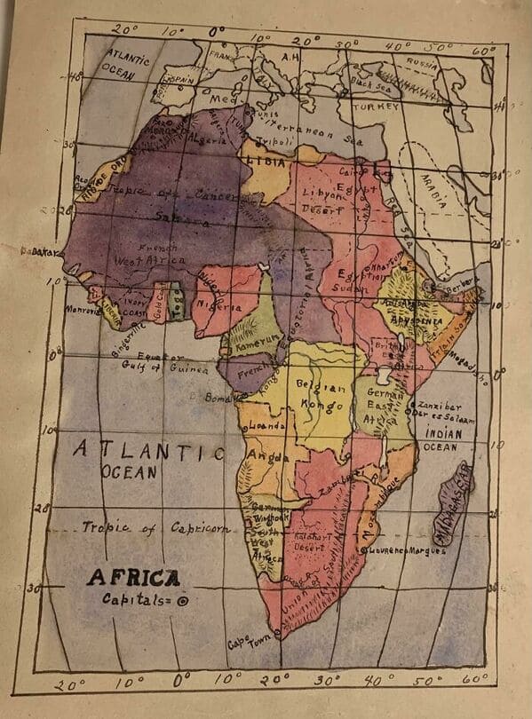
8. “My Great Grandpa Drew This Map Of Africa In The 1910’s”
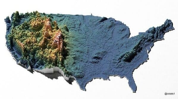
9. “United States Elevation Map”
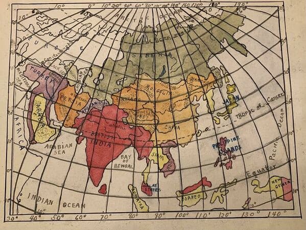
10. “Since You All Liked My Great Grandpa’s Drawing Of Africa At Age 12, Here’s One He Did Of Asia (Ca. 1910’s)”
11. “Europe In The Style Of Super Mario”

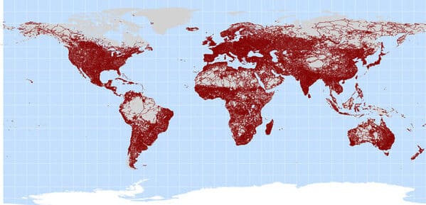
12. “A Map Of All Of The World’s Roads”
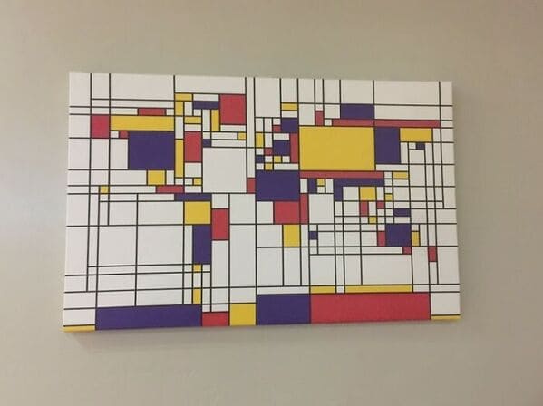
13. “Abstract World Map”
14. “Some Alternate Maps Of Down Under”

15. “Countries That Recognises The Uyghur Genocide As Of February 26, 2021”

16. “Map Of Most Photographed Places In The World”

17. “World Map Resized According To Population”

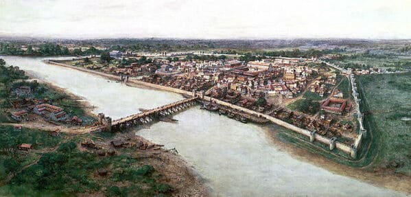
18. “An Artists’ Impression Of The Roman Port City Of Londinium, Established Between 47-50 Ad”
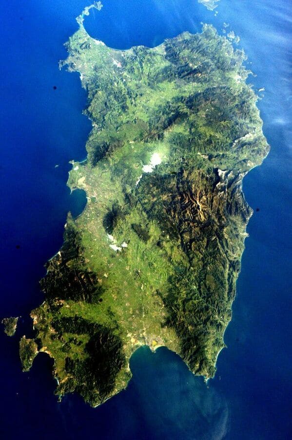
19. “The Island Of Sardinia As Seen From The International Space Station”
20. “The Roman Empire vs. The Mongol Empire At Their Peaks”

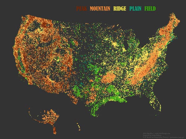
21. “Place Names That Contain The Word ‘Peak’, ‘Mountain’, ‘Ridge’, ‘Plain’ And ‘Field’ In The United States”
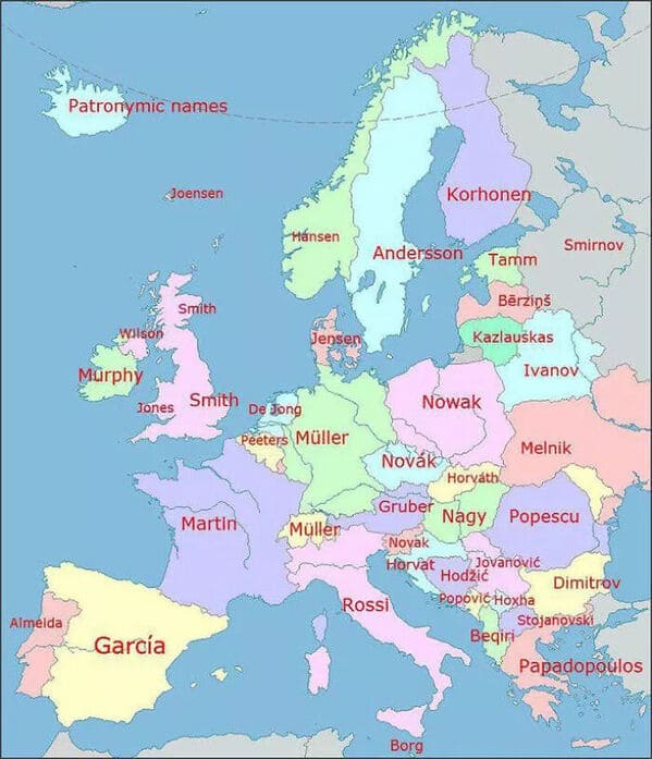
22. “Most Popular Last Names In Europe”
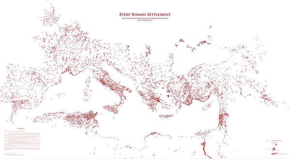
23. “Every Roman Settlement, And Nothing Else”
24. “La Plata.. Buenas Aires.. Argentina”

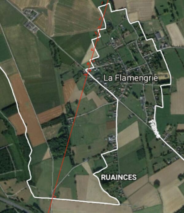
25. “In A Straight Line You Can Go From Belgium To France 11 Times”
26. The word “soda” takes over.

27. “People Employed In Science And Technology In Europe”

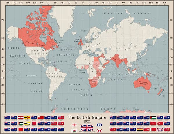
28. “The British Empire At It’s Territorial Peak”
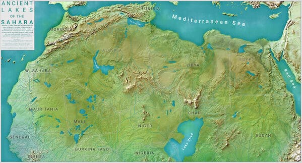
29. “Ancient Lakes Of The Sahara”
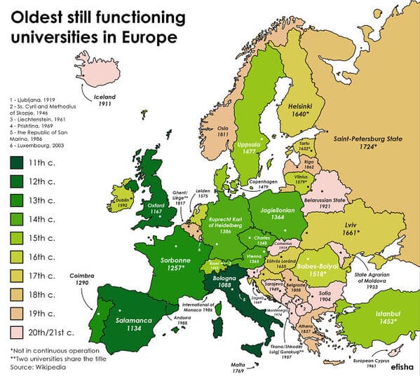
30. “Oldest Still Open Universities In Europe (The Word University Is Omitted On The Map)”
31. “In Which State You Can Find The Highest Percentage Of People With Ancestry From Every European Country?”

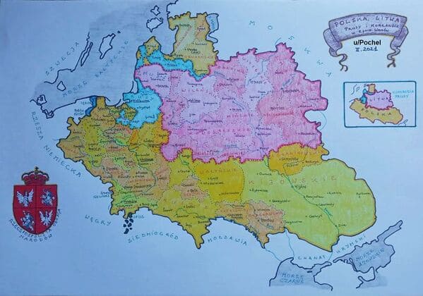
32. “Hand-Drawn Map Of The Polish-Lithuanian Commonwealth In 1618, By Me”
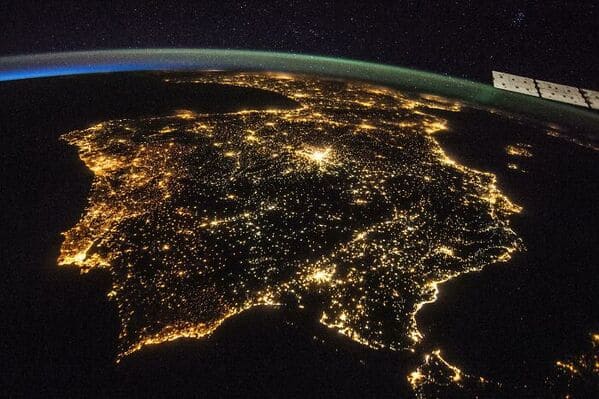
33. “The Iberian Peninsula At Night By Nasa”