There’s A Map For That (18 Interesting Pics)
Now maps are apps, but it used to be a 27’x27′ piece of paper folded up in your dad’s glovebox. We’ve come a long way.
Maps are incredible now. With the ability to make them on computers mixed with the sheer amount of knowledge we’ve amassed, you can pack a lot of information into one. Here are the 15 best I found this week.
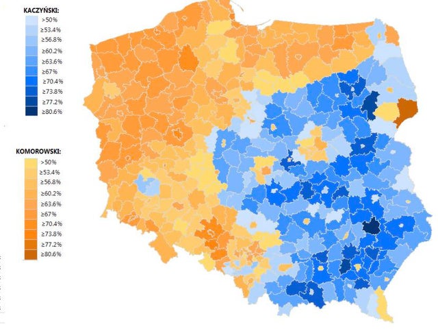
1. 2010 Polish Presidential Election nearly lines up with the old Imperial German border.
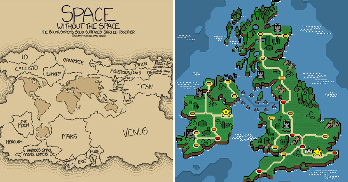
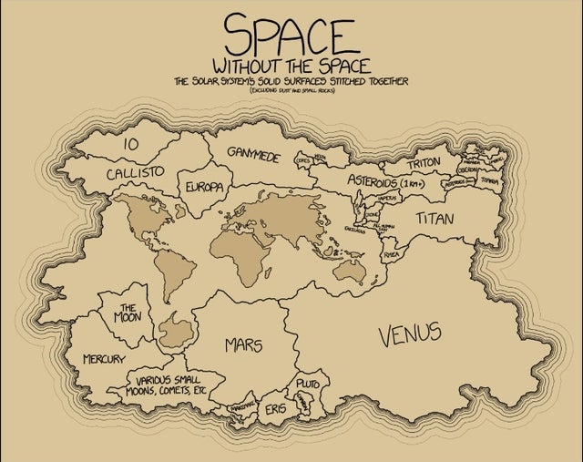
2. The Solar System’s solid surfaces stitched together.
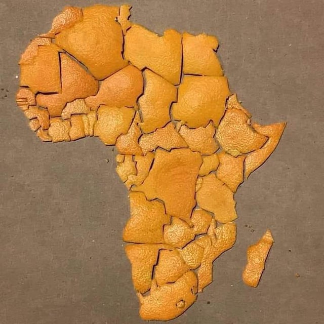
3. Map of Africa, using orange peel.
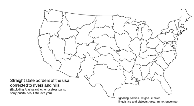
4. Europeanized America
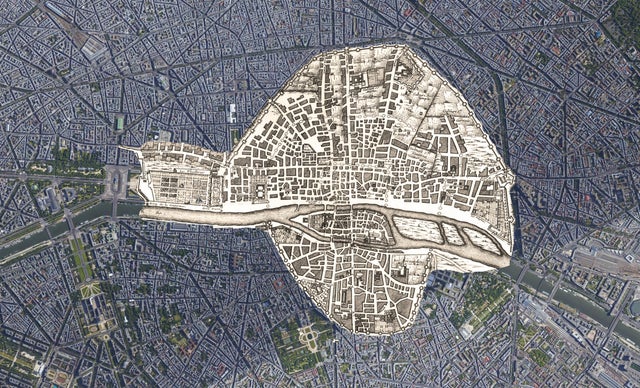
5. 1422 Paris map on top of today Paris.
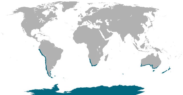
6. Where penguins are found naturally in the world.
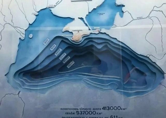
7. Black Sea.
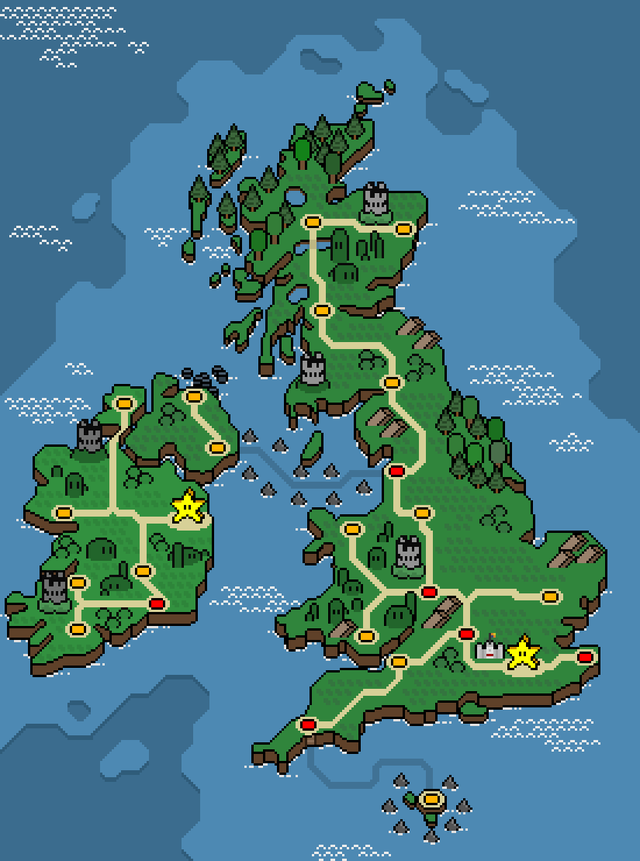
8. Here’s my map of the British Isles in the style of Super Mario World
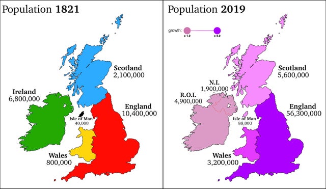
9. Population Change of Britain & Ireland over 200 years.
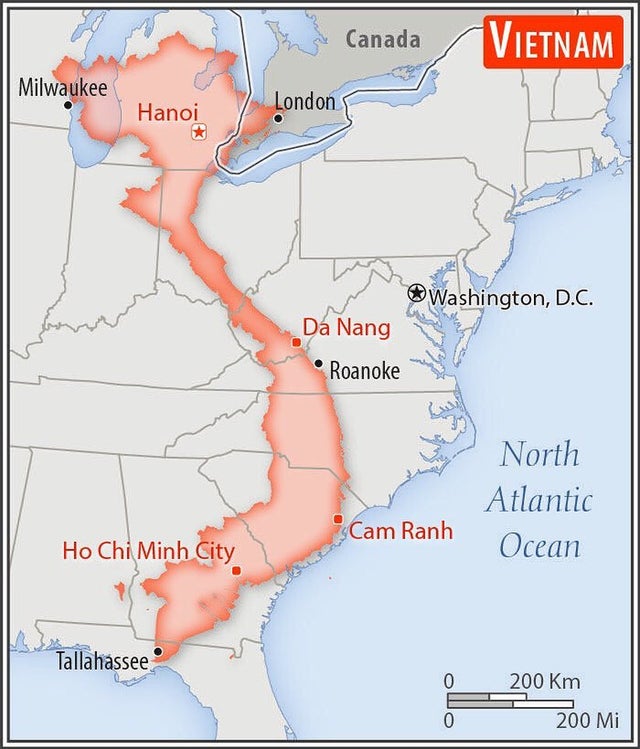
10. Size comparison of Vietnam with the eastern United States.
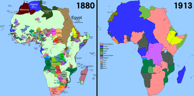
11. Africa in 1880 compared to 1913
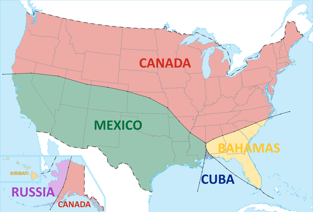
12. The nearest country to everywhere in the US.
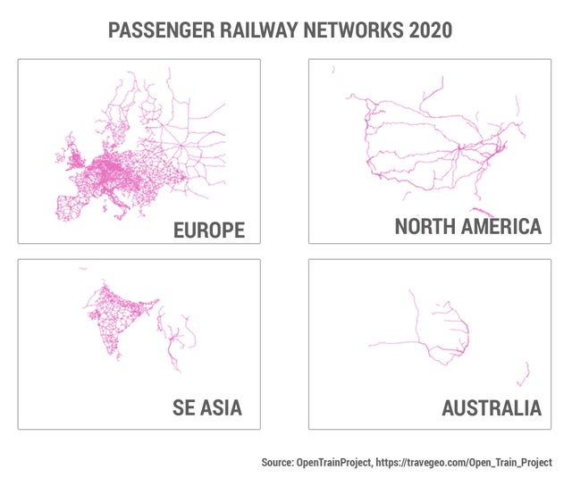
13. Passenger railway network 2020.
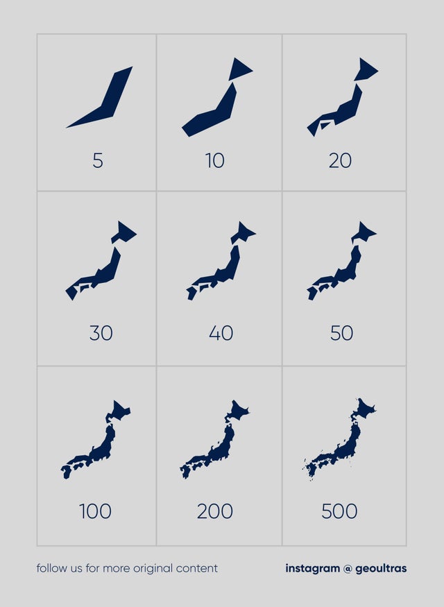
14. Map of Japan made from 5 to 500+ edges.
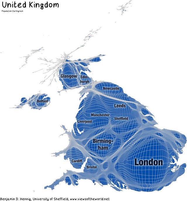
15. Population cartogram of the United Kingdom.
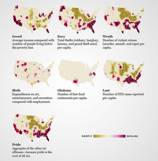
16. The US mapped by the 7 deadly sins.
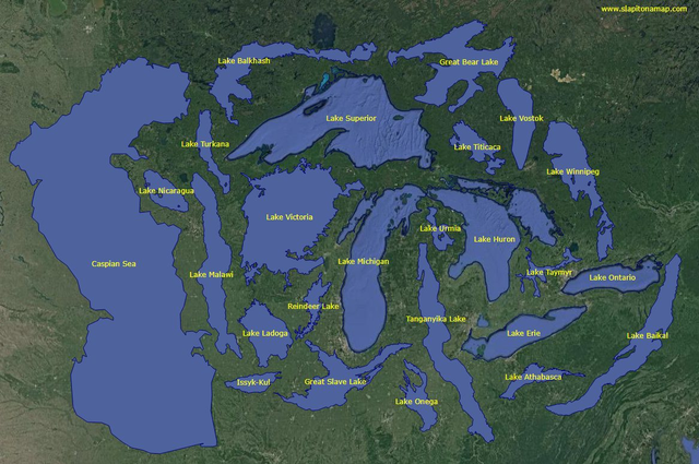
17. World’s 25 Largest Lakes side by side.
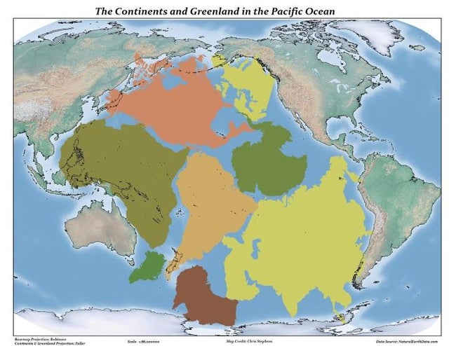
18. The pacific is just that big.