45 Interesting Maps Of America That May Just Teach You Something You Don’t Know
Before the invention of the GPS people used these things called maps.
They would tell you where you needed to go as long as you had a magnifying glass and a place to stop and ask a gas station clerk if you were heading in the right direction.
Now, maps are fun. Maps can explain America in more ways than just the direction we’re going. They can tell us the largest coffee chain per state and even track the eye color of each governor by state. Maps like this explain America in a way you probably haven’t thought of before.
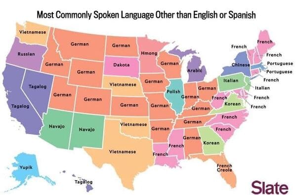
1. “Most Commonly Spoken Language In The U.S. After English And Spanish”
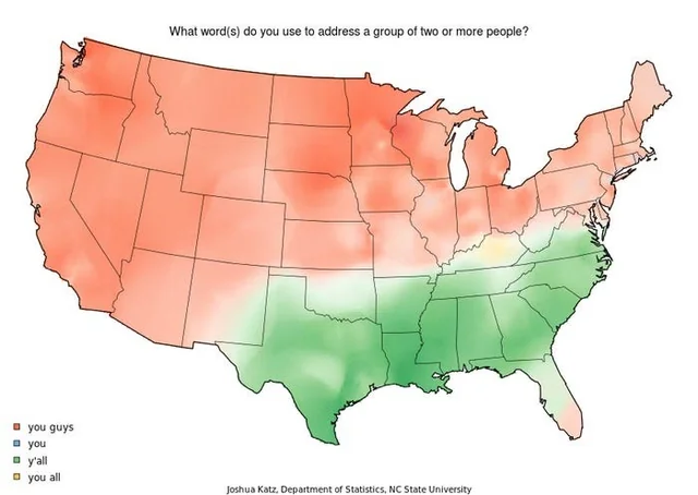
2. “What word(s) do you use to address a group of two or more people?”
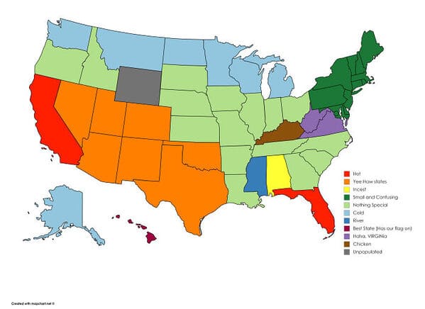
3. “How I, A Brit, See The United States (Sorry If It Offends Anyone)”
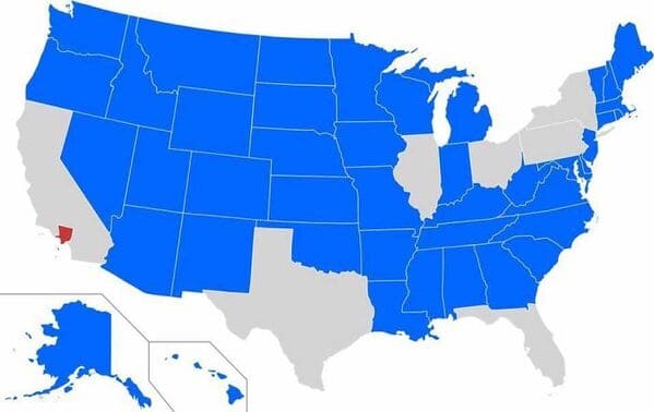
4. “States With A Smaller Population Than Los Angeles County”
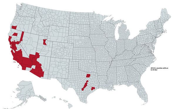
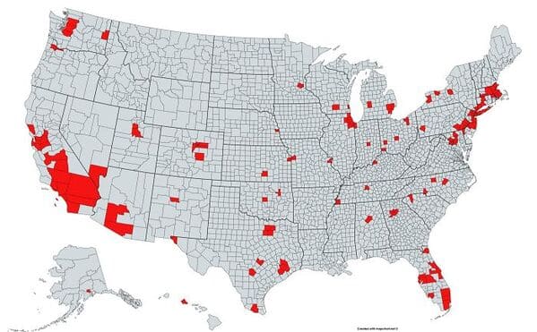
5. “All U.S. Counties With In-N-Out Burger As Of May 2020”
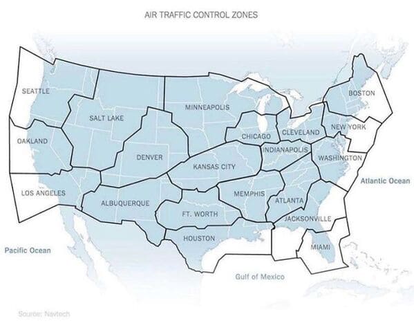
6. “Air Traffic Control Zones In The USA”
7. “United States Population Lines”

8. “Garbage Can vs. Trash Can In The United States”

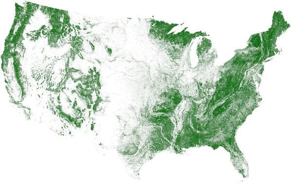
9. “Tree Cover Map Of The US”
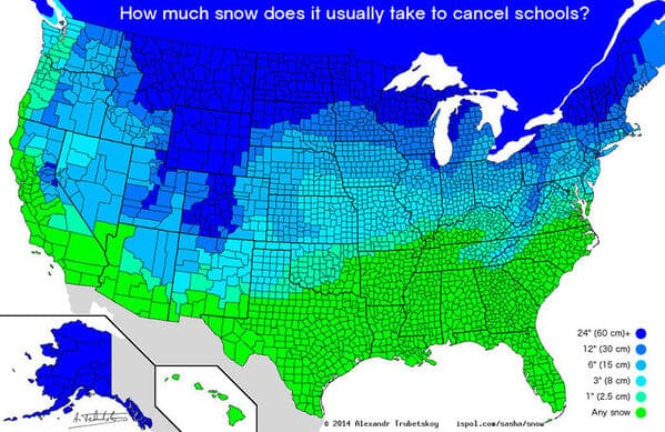
10. “How Much Snow Does It Usually Take To Cancel Schools?”
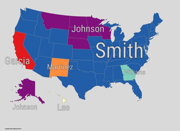
11. “Most Common Surname In The United States By State”
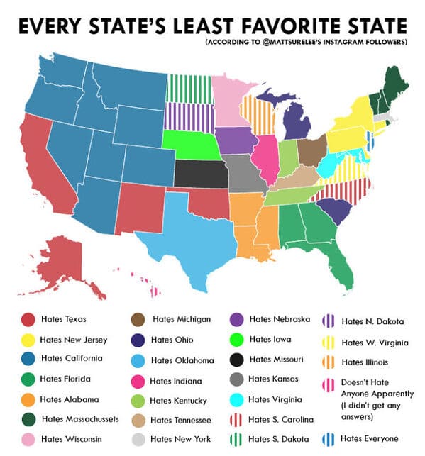
12. “Every State’s Least Favorite State”
13. “It’s Very Interesting”
14. “More People Live Inside The Red Area Than The Grey Area”
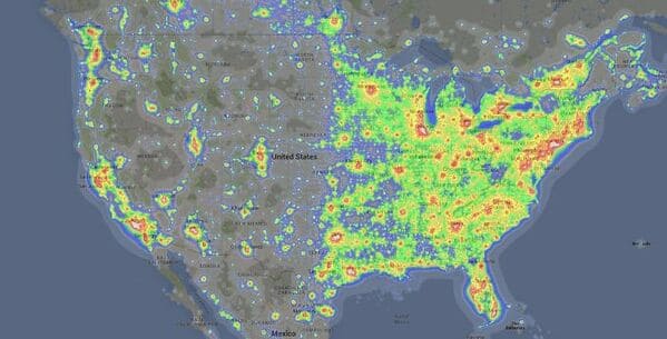
15. “Light Pollution In The United States”
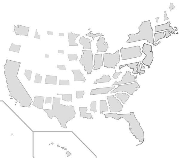
16. “US States Scaled Proportionally To Population Density”
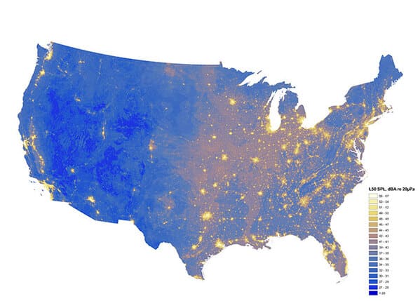
17. “The Loudest And Quietest Spots In The Continental US”
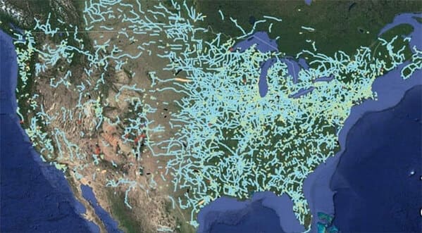
18. “Out Of Service Railways”
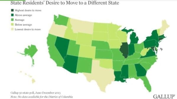
19. “The U.S. Mapped By Residents’ Desire To Move To A Different State”
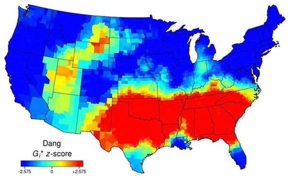
20. “Use Of The Word “Dang” Across The Continental US”
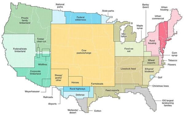
21. “How America Utilizes Its Land”
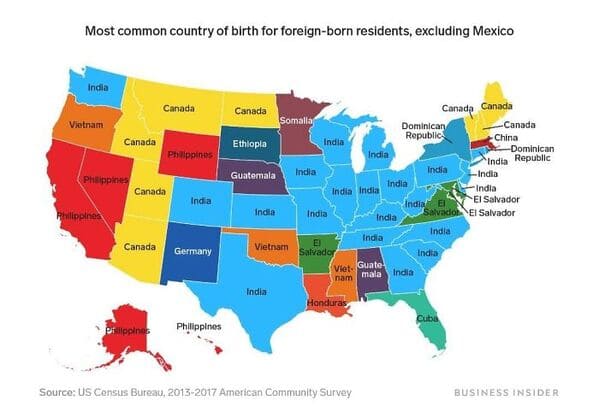
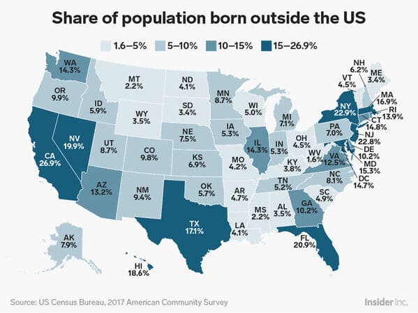
22. “Percentage Of People Born Outside The U.S. In Each State”
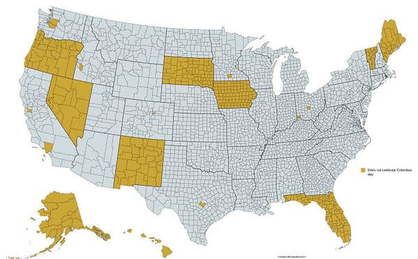
23. “Regions Of The U.S. That Don’t Officially Celebrate Christopher Columbus Day”
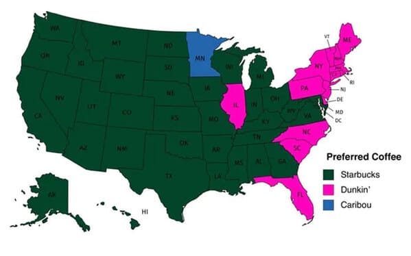
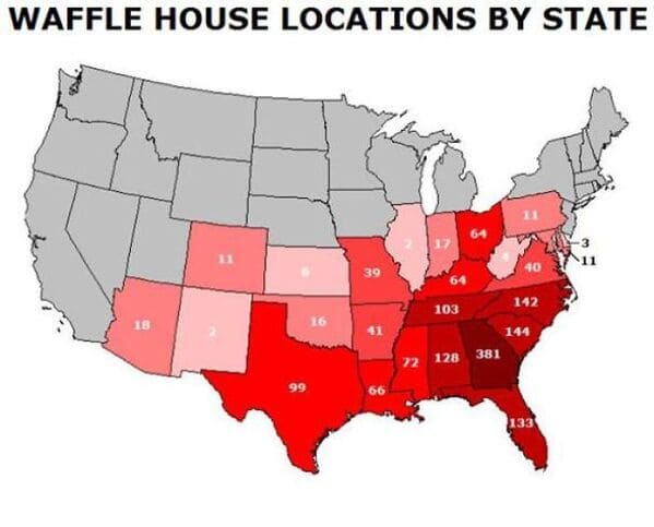
24. “Popular Coffee Shop Chains By Number Of Locations”
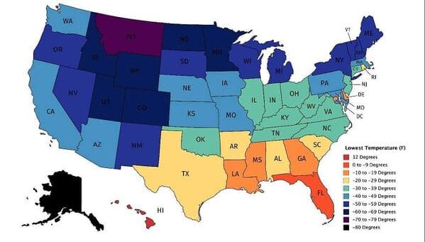
25. “Map Of Lowest Recorded Temperature In Each Us State (Fahrenheit)”
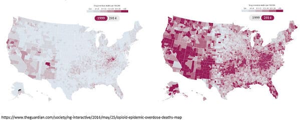
26. “Drug Overdose Deaths In The United States Per 100,000 Persons For 1999 And 2014”
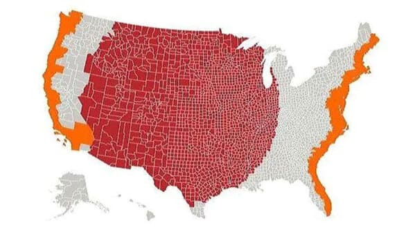
27. “Red And Orange Areas Have Equal Populations”
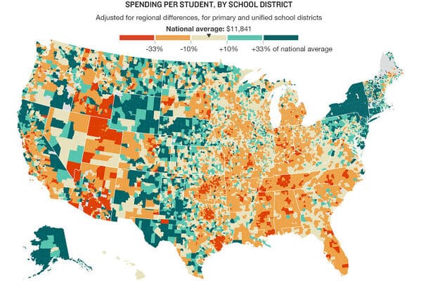
28. “U.S. Education Spending Map”
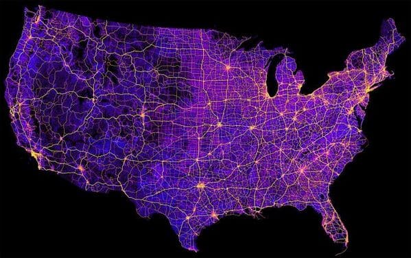
29. “Map Of The United States’ 8 Million Miles Of Roads, Streets And Highways”
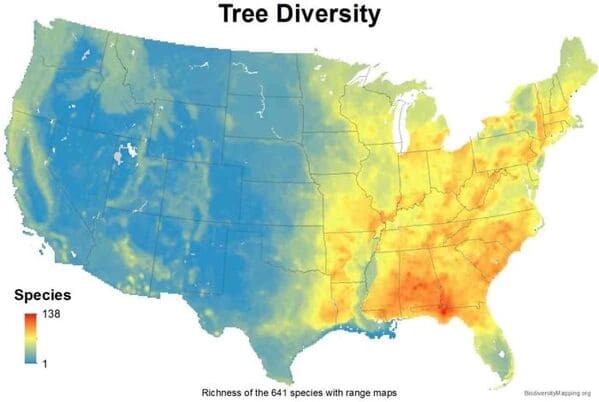
30. “USA Tree Diversity”
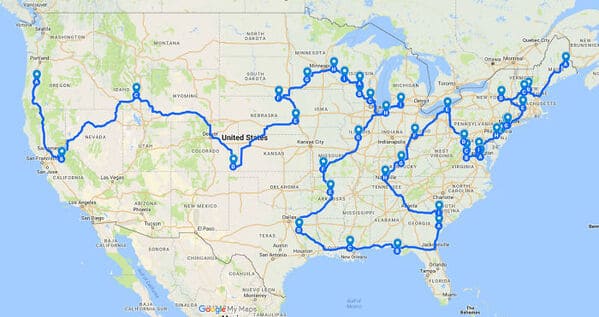
31. “The Most Efficient Route Between Every Springfield In The United States”
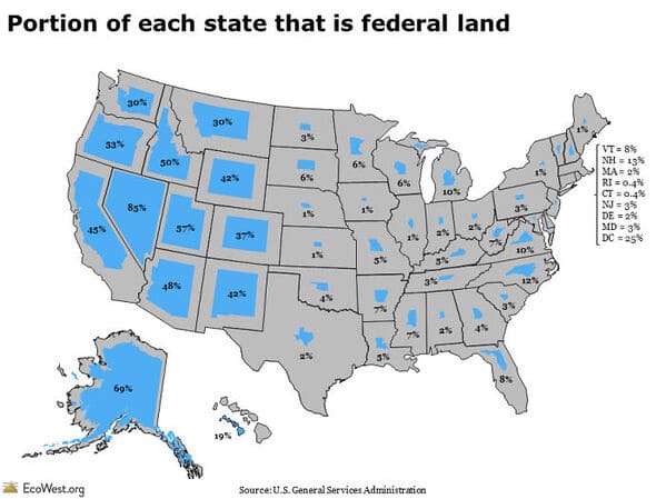
32. “Portion Of Each State That Is Federal Land”
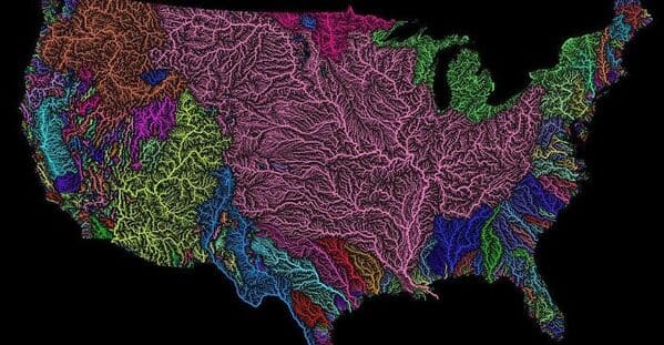
33. “US Watersheds”
34. “A Tastier Map”
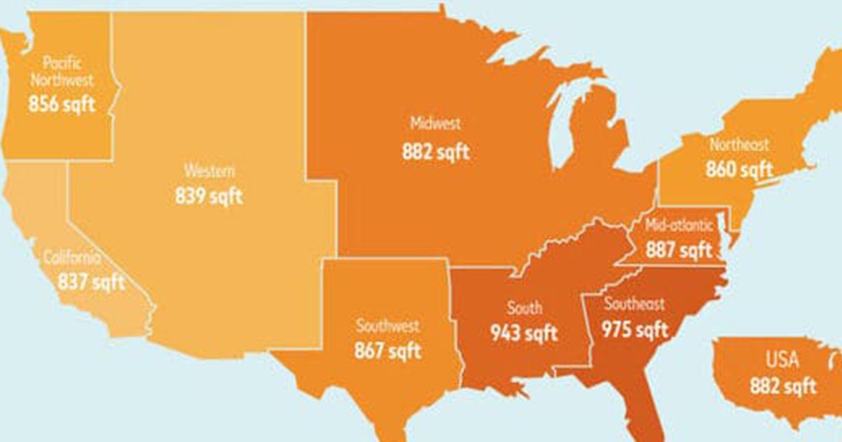
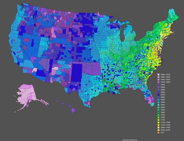
35. “Date Of Creation Of All 3,142 U.S. Counties”
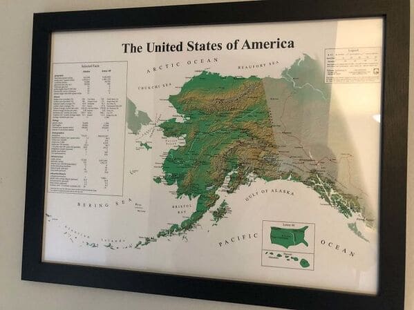
36. “The United States Of America: Alaskan Perspective”
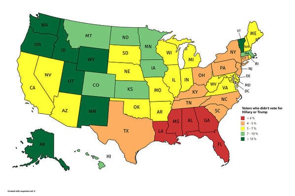
37. “Voters Who Didn’t Vote For Hillary Or Trump”
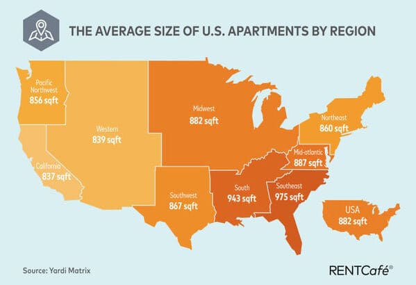
38. “Average Size Of US Apartments By Region”
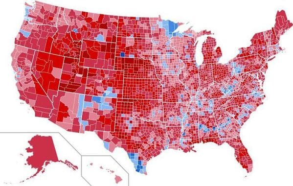
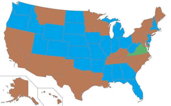
39. “Results Of The 1984 United States Presidential Election By County. The Most Lopsided Election In History, The Only State Reagan Failed To Win Was His Opponent’s, Minnesota”
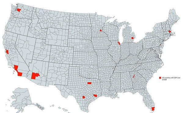
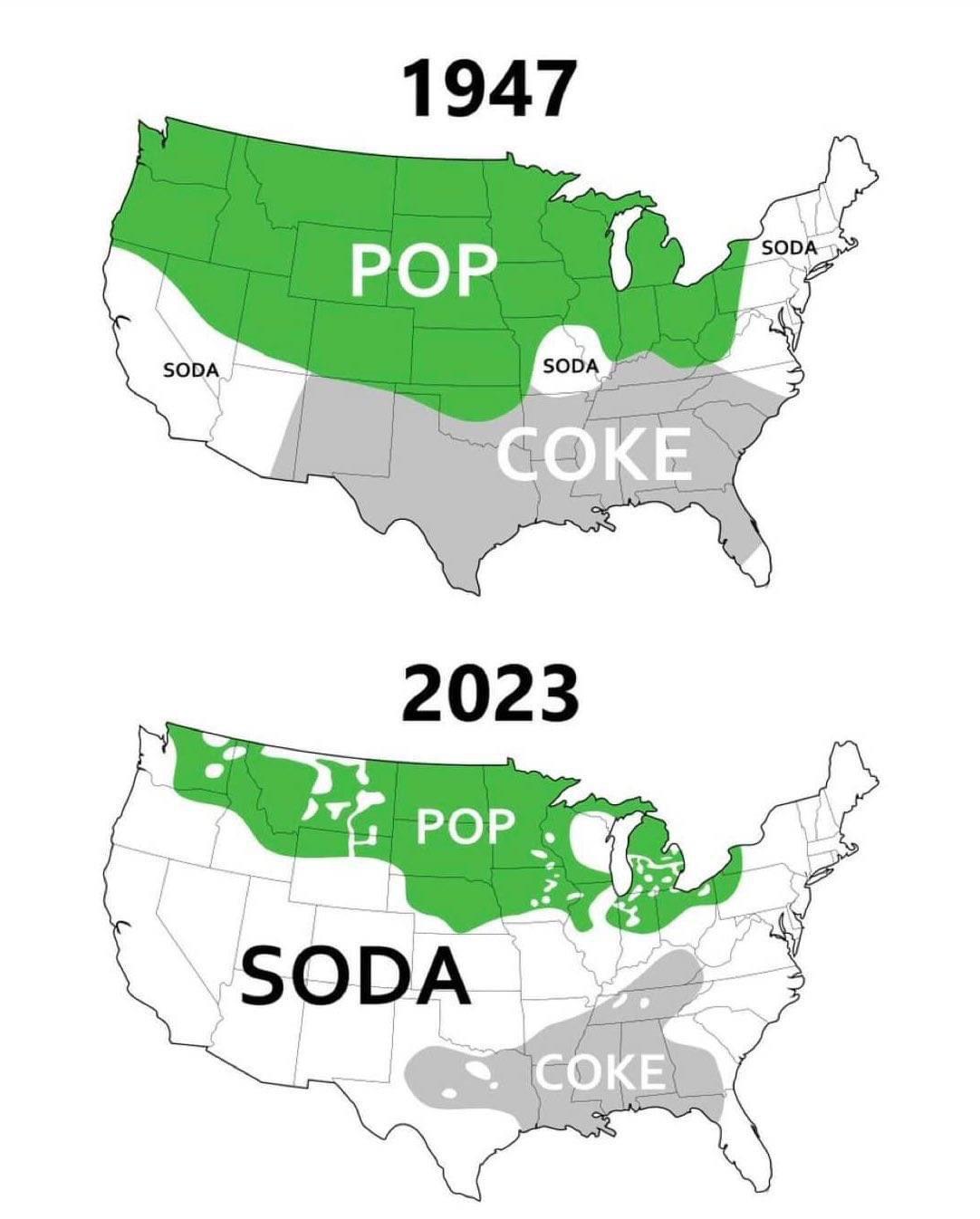
40. “US Counties With Gdp Over $100b”
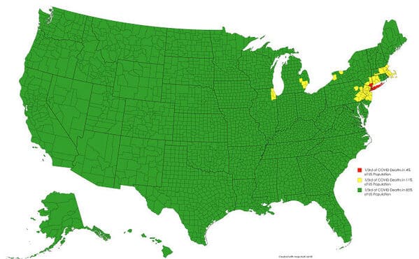
41. “USA Country Map Divided By 1/3rds Of Covid Deaths”
42. “US Governors By Eye Color”
43. “Use of “Pop” vs “Coke vs “Soda” to Refer to Sweet Carbonated Beverage in US Over the Years”
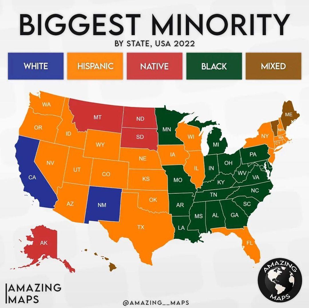
44. “Biggest Minority by state, USA 2022”
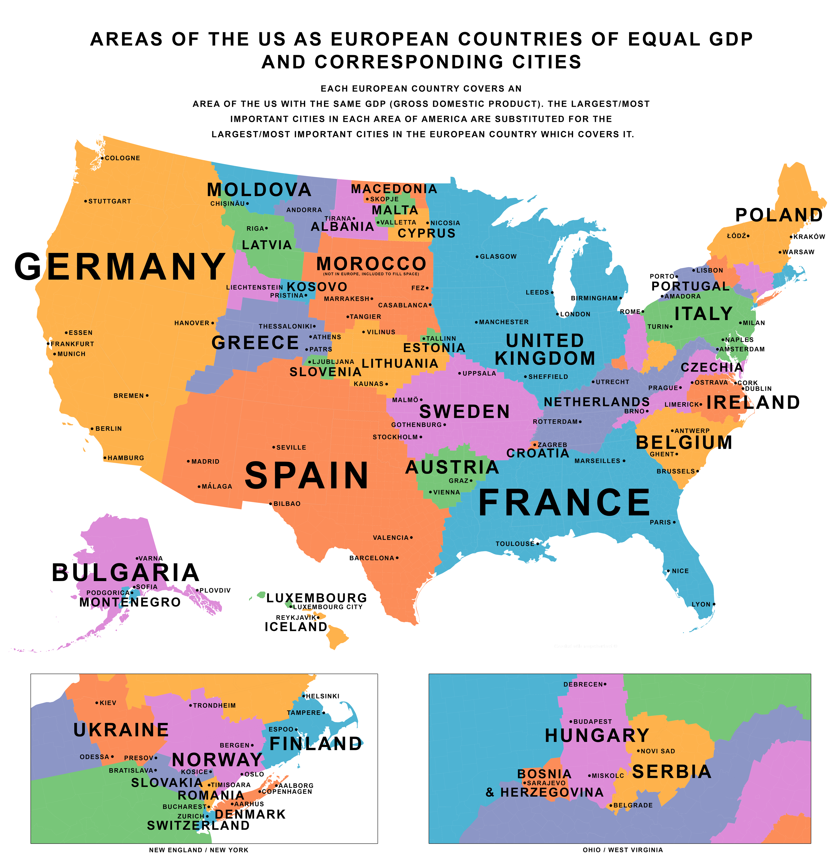
45. “Areas of the U.S. as European countries of equal GDP & corresponding cities”